

MUSEUM DUNIA MAYA DR IWAN S.

Dr IWAN ‘S CYBERMUSEUM
THE FIRST INDONESIAN CYBERMUSEUM
MUSEUM DUNIA MAYA PERTAMA DI INDONESIA
DALAM PROSES UNTUK MENDAPATKAN SERTIFIKAT MURI
PENDIRI DAN PENEMU IDE
THE FOUNDER
Dr IWAN SUWANDY, MHA

WELCOME TO THE MAIN HALL OF FREEDOM
SELAMAT DATANG DI GEDUNG UTAMA “MERDEKA
The Driwan’s Cybermuseum
(Museum Duniamaya Dr Iwan)

Showroom :
Dr Iwan Book :
“The Vintage Timor Kupang ,Flores and related Area”
_______________________________________________________
THE VINTAGE TIMOR KUPANG
AND RELATED AREA COLLECTIONS
PRIVATE LIMITED E-BOOK SPECIAL FOR COLLE CTORS.

Created by Dr IWAN S from many vintage books and His private collections
Limited Private Edition 100 expl special for Premium member
JAKARTA @copyright Dr IWAN S 2011
hhtp://www.Driwancybermuseum.wordpress.com
___________________________________________________________________
PREFACE
Timor Kupang and related area in Indonesia was called Nusa Tengara Timur Province, Kupang is the capital city at Timor Island, another island were Sumba,Solor, Alor,Flores ,komoko ,roti and Timor Indonesia,border with Timor leste.
Before world world II , two ilsnad Sawu and Raidjua under (onderafdeling) Roti or Sawu which one leader chief or Raja ,the latest raja was Paulus Charles Djawa or Rohi Rihi Djawa which was died in 1963. After the world war II Sau and Raijdua Island still under Roti area under Kabupaten (Subprovinsi) Kupang, with two Kecamatan Sawu Timur and Sawu Barat.
I NEVER VISIT THIS AREA,BUT IN 1999 DURING MY DUTY TO TIMOR DILI(now TIMOR LESTE), I have seen from the fligth the beautiful three color Kalimutu Lake,

and many of my nurse and the wife of health personil were evacuated from Dilli to Kupang Timor due to the worst situation before the Timor leste elections between freedom and autonom Indonesian Province.
Very difficult to find the Timor Kupang collection in Sumatra and Java or Bali, bacause not much communications between that area, but some Timor Kupang man which moved to Jakarta still bring their vintage books and picture collections and when they were passed away their family throw away teir collecrtions and I have found some rare collections from the Lapak, and in 2008 i found some postal history from that area which belonging of a snior collectors from Macassar,cutting fragment from his letter from that area ,very pity but still us a rare info from the small city in the Flores and Timor Island.I have aslo found vintgae book about that area early textile and embroidery.
If the c ollectors have MORE INFO FROM THIS AREA PLEASE CONTACT ME VIA COMMENT, THANK YOU.
Jalkarta June 2010
The author
Dr IWAN S
KATA PENGANTAR
Timor Kupang dan daerah terkait di Indonesia disebut Propinsi Nusa Tenggara Timur, Kupang adalah ibu kota di Pulau Timor, pulau lain adalah Sumba, Solor, Alor, Flores,, komoko roti dan Timor Indonesia, perbatasan dengan Timor leste.
Sebelum dunia dunia II, dua pulau Sawu dan Raidjua dibawah (onderafdeling) Roti atau Sawu yang satu pemimpin kepala atau Raja, raja terakhir Paulus Charles Djawa atau Rohi Djawa Rihi yang meninggal pada tahun 1963. Setelah perang dunia II Sau dan Pulau Raijdua masih dalam Roti daerah di bawah Kabupaten (Subprovinsi) Kupang, dengan dua Kecamatan Sawu Sawu Timur dan Barat.
Saya PERNAH berKUNJUNGAN ke DAERAH INI, TAPI TAHUN 1999 SELAMA SAYA MASUK KE DILI TIMOR (TIMOR LESTE sekarang), saya pernah melihat dari pesawat udara keindahan danau tiga warna ,Danau Kelimutu,

dan banyak perawat dan istri personil kesehatan dievakuasi dari Dili ke Kupang Timor karena situasi terburuk sebelum pemilu Timor leste antara kebebasan dan otonom Propinsi Indonesia.
Sangat sulit untuk menemukan koleksi Timor Kupang di Sumatera dan Jawa atau Bali, karena tidak banyak komunikasi antara daerah itu, tetapi beberapa orang Timor Kupang yang pindah ke Jakarta masih membawa buku lama mereka dan koleksi gambar dan ketika mereka meninggal dunia keluarga mereka membuang koleksi tersebut dan saya telah menemukan beberapa koleksi langka dari Lapak, dan pada tahun 2008 saya menemukan beberapa sejarah pos dari daerah yang dimiliki seorang kolektor senior dari Makassar, pemotongan fragmen dari surat dari daerah itu, sangat sayang tapi masih kita info langka dari kota kecil di Flores dan pulau Timor .Saya juga menemukan buku lama tentang tekstil dini dan sulaman dari daerah ini.
Jika para kolektor memiliki INFO DARI DAERAH INI SILAHKAN HUBUNGI SAYA VIA COMMENT, TERIMA KASIH
Jalkarta Mei 2011
Penulis
Dr IWAN
___________________________________________________________________
CHAPTER ONE:
THE VINTAGE PICTURES COLLECTIONS.

1. The Koepang horse race June 1927


2.The koepang Seaport (a part of picture ,full panoramic look at the complete e-book)

3. The ethnic Kupang family and their house Sept.2nd1924

4. The ethnic Kupang man in their house 1924

5. ethnic pictures

(1) ethnic Kupang
(2) Ethnic Flores

(3) ETNIC SOLOR
 |

(4) ETHNIC ROTE (ROTI) ISLAND

Korbafo chief with warriors, 1900.
CHAPTER TWO
THE EARLY TEXTILES AND EMBROIDERY COLLECTIONS

1. THE SUMBA ISLAND EARLY TEXTILE

(1) SUMBA PENNANT(PENJI?) WITH LIZARD BEADS EMBROIDERY. CIRCA 1900
(2)Lau Pahudu (women’s cremonial skitrs) design human figure
(3)Lau Pahudu tubular decorated Bands 19th century
(4)Lau Katipa applique Band design dancing horse late 19th century.

2. TIMOR KUPANG EARLY TEXTILE
(1) TIMOR KUPANG EARLY TEXTILE EMBROIDERY HANING IN THEIR HOUSE 1924

3.FLORES EARLY TEXTILE

(1) EAST FLORES APPLIQUE BAND WITH HUMAN DESIGN
4. SOLOR EARLY TEXTILE

(1) WOMEN SARONG DESIGN ROSTER AND GEOMETRIC LINE.
5. ROTI ISLAND EARLY TEXTILE
(1)APPLIQUE BAND DESIGN SPIRAL LINE.
(2) WOMEN SARONG SKIRT DESIGN LINE AND RAIDING HORSE.

CHAPTER THREE
THE POSTAL HISTORY COLLECTIONS
1.TIMOR ISLAND
KOEPANG


2.FLORES ISLNAD
1. Maumere(Sikka Regency)


2. Ende(Ende Regency)


3.Ruteng (Manggarai Regency)


4.Larantuka (East Flores)
5.Bajawa(Ngada Regency)
6.Labuan Bajo( East Manggarai regency)

7.Mbay(Nagekeo regency)
8.Borong Est Manggarai regency)
| hhtp ://www.Driwancybermuseum.wordpress.com | |||||

 |
 |
|
|
|
The next morning, I left hospitable Moni and began a journey to the central part of Flores. The bus was very crowded as usual. Public transport in Indonesia was relatively cheap and it was virtually the only way to move around. In almost every village, passengers traded places and each bus stop was turned into a small bazaar. The road mainly followed a wide river valley, winding around cultivated fields and banana plantation. Two hours later the road approached the coast and I reached Ende, the biggest town on Flores and capital of the island. It was also the most important port for the whole region.
|
|
|
|
 |
|
|
|
The town had a very beautiful location at the foot of several volcanoes. The most famous of them was Gunung Meja with an almost perfectly conical shape and a flat summit. Another volcano, Gunung Ipi, a little bit further south, was still considered active. Waiting for another bus, I could admire a beautiful view of tropical beaches with black, volcanic sand and coconut palm trees bowing to the sea.
|
|
|
In Bajawa District, 60,000 Ngada people were living on a large plateau where Bajawa is located and also on the southern slopes of the volcano Inerie. The Ngada were the most well known ethnic group of Flores because they had preserved, far better than most, their unique culture, customs and traditional architecture. Almost all Ngada people were Roman-Catholic, but at the same time, they also practiced their ancient animistic beliefs. Bajawa was the tourist centre of the whole region and jumping off point to the neighbouring traditional Ngada villages.
|
 |
 |
|
|
|
The first of the villages, Langa was located just a few kilometres from the town. It was also very typical. The main square of the village contained two characteristics for Ngada cultural elements: five nghadu and four bhaga. Nghadu were similar to umbrellas in structure, consisting of a three-meter long stick and a reedy roof. A small statue of a man toped them, often with a headband, holding a parang (machete) in one hand and a spear in the other one. A Bhaga was a miniature of a house with the steep roof. The meaning and function of nghadu and bhaga were various but first of all they were supposed to symbolise the presence of ancestors. The nghadu was always masculine and bhaga feminine, and each pair belongs to a particular family group living in the village. The carved sticks of nghadu were always very solid like a rock; however, their top parts were often in poor condition. It was said that some of them have been carved to commemorate people killed during ancient land disputes and were more than 100 years old. The main trunk of a nghadu, called Sebu, must had come from a special type of wood and must had been dug out together with its roots, transported to the village along a direct line, and planted in a specific place.
|
|
 |
 |
|
|
|
Another village, Bena was located 10 kilometres further south of Langa. A narrow road winded to the foot of the perfect cone of the extinct volcano Inerie (2245m). Bena was the most typical and best preserved of all villages in the area and consisted of two rows of houses with tall, steep rectangular roofs supported by two sticks. There was an empty space between them containing several nghadu, bhaga, and mysterious megalithic structures. The whole complex rose gradually up the hill.
|
|
 |
 |
|
|
 |
 |
|
|
.
History
Flores owes its name to the Portuguese, who called its eastern most Cape Cabo Das Flores, meaning Cape of Flowers. The island diverse cultures have enough similarities to suggest that they developed from common ancestry, differentialed by geographical isolation and varying influence of outsiders. Long before Europeans arrived in the 16 century, much of coastal Flores was firmly in the hands of the Makasarnese and Bugis from southern Celebes ( Sulawesi ).
As early 1512, Flores was sighted by the Portuguese navigator Antonio de Abreu and Europeans had probably landed by 1550. The Portuguese involved in the lucrative Sandalwood trade with Timor, built Fortresses on Pulau Solor ( Solor island ) eastern of flores island .and at Pulau Ende ( Ende island ) south coast of central of Flores. In 1561 Dominican Priests established a mission on Pulau Solor. Christianity was a successful import and today a church is the centerpiece of almost every village.In the 17 century, the Dutch kicked the Portuguese out of flores. Ternate and Gowa ( a part of Molluceas island ) also ceded all their rights on Solor, Flores and eastern Sumbawa to the Dutch, giving them nominal control, but it was too complex and isolated to rule effectively 
. Around 1850 the Dutch purchased Portugal’s remaining enclaves in the area, including Larantuka , Sikka and Paga. Even into the first decade of the 20th century, the Dutch were constantly confronted with rebellions and inter – tribal wars. Unrest continued until a major military campaign in 1907 subdued most of the tribes of central and western Flores. Missionaries moved into the isolated western hills in the 1920’s.
Flores is holding its breath for provincial statues . This will be a huge development for the island, as it is currently under the jurisdiction of Kupang and the Nusa Tenggara Timor ( NTT ) government and has only limited control over its affairs.
Geography
The island’s turbulent volcanic past has left a complicated relief of V – shaped valleys, knife edged ridges, and a collection of active and extinct volcanoes.
One of the finest volcanoes is the caldera of Kelimutu in Central Flores, with its three colored lakes. There are 14 active volcanoes in Flores. 
Only Java and Sumatera have more. The central mountains slope gently to the volcanoes plunge steeply into the sea.
In the island is part of one of the worlds most geologically unstable zones, and earthquakes and tremors hit every year. In December 1992 an earthquake measuring 6,8 on the Richter scale, and then massive tidal wave that followed it, killed around 3000 people in eastern Flores and Flattened much of Maumere.The rugged terrain makes road construction difficult, although Flores is only about 375 km long, its main east – west roads winds, twists, ascends and descends for nearly 710 km – that is almost 2 – for – 1.
Climate
The rainy season ( November to March ) is more intense in western Flores, which receives the brunt of the north – Flores highest peak ( The 2400mGunung Ranaka ), gets an average of 3350mm of rain every year. But Ende , Maumere, have only 1140mm and Larantuka recevest 770mm.
Religion
Around 85% of the people are Catholic but in rural areas particularly, Christianity is divided onto traditional beliefs 
. Animistic rituals are still important here for a variety of Occasions, ranging from birth, marriage, and death to the building of new houses, or to mark important points in the agricultural cycle. Even educated, English – speaking Florinese still admit to the odd chicken, pig ,or buffalo sacrifice to keep their ancestors happy when rice is planted or a new field opened up. In former times, it took more then animal blood to keep the Gods and spirits friendly, there are persistent tales of children or virgin girls being sacrificed. Muslims tend to congregate in the coastal towns such as Ende where they make up half population.
Administration
Flores is part of the East Nusa Tenggara province. The island is split into eight regencies (local government districts); from west to east these are: West Manggarai,Manggarai,east Manggarai, Ngada, Nagekeo, Ende, Sikka and Flores Timur.
Tourism
The most famous tourist attraction in Flores is Kelimutu; three coloured lakes in the district of Ende. These coloured lakes change colours on a regular basis 
. The latest colours (late 2004) were said to be turquoise, brown and black.
There is good snorkelling and diving on several locations along the north coast of Flores, most notably Maumere and Riung. However, due to the destructive practice of local fishermen using bombs to fish, and locals selling shells to tourists, the reefs are slowly being destroyed.
West Flores is also the best place for eco tours, trekking, hiking, and birds watching
CHAPTER FOUR:
THE ANTIQUARIAN AND OLD BOOKS COLLECTIONS
I. ANTIQUARIAN BOOKS
(1)THE ETHNIC LESSER SUNDA (NUSA TENGARA) 1868 (Berlin Ethnographic edition) with colour Engraved Pictures.

(2). KUPANG IN 1890 (KUPANG TAHUN 1890)
Beitrage Zur Ethnographie der Timorgruppe(vons Dr H.Ten Kate)

Ethnografi dari group Timor (oleh Dr H. Ten Kate)
Hanya satu Kontribusi berikut ini dinawarkan kepada saya , yaitu tahun 1890-1891 atas nama Masyarakat Royal. Belanda , Geografis Perjalanan dilaksanakan ke beberapa pulau Timor di Semenanjung Hinndia Belanda.

Bahkan kisah perjalan tersebut , telah saya laporkan secara terperinci pada tulisan di tempat lain dan dikomunikasikan dengan baik pengamatan etnografi dan catatan keselamatan secara umum dalam laporan perjalanan. Hanya hal ini yang tersisa bagi saya, karena itu untuk hanya keterangan lebih lanjut tentang koleksi saya, yang sekarang tergabung dalam Museum Nasional Ethnographical ,.

Walaupun sama, termasuk beberapa disusun oleh saya di 1892 dikumpulkan subjek lebih Sudsee, dari 696 angka yang saya berikan di sini tetapi pilihan untuk membatasi diri dengan info yang baru atau kurang dikenal. Koleksi Saya telah dipermudah dengan kepustakaan yang relevan, lebih atau kurang secara terperinci etnografi untuk merancang pulau yang warganya saya telah kunjungi , namun saya tidak melakukannya, karena menurut saya canggung seperti sia-sia oleh orang lain untuk mengulang apa yang telah diceritakan. Saya telah membatasi diri untuk hanya selecta etnografi dari koleksi saya dan hanya orang-orang dari catatan lapangan saya dengan aphoristic nilai absolut yaitu Logie Ergo, Sarasin’schen dalam arti orang tersebut.

Dari pulau yang saya berkesempatan untuk mengunjungi, Sumba atau Pulau Sandal sangat aman atau ia masih sedikit dikenal dan hanya ada objek koleksi etnografi dan yang sangat sedikit adalah Flores, terkait begitu lama sebelum saya pergi, tetapi sebelumnya sudah menjadi info berharga “Catatan Etnografi (suplemment untuk Bd III lokio Ar International untuk Etnografi) oleh Prof Max Weber ” tapi saya juga telah menemukan vorgonnt Baru untuk pelengkap dan sudah akrab dalam beberapa hal di sini selama dipulau Solor, Adunara, Saman. dan Roti (Red) Umumnya dikomunikasikan agar dapat info baru, dan meskipun dari pulau Timor dengan perjalanan De Freycinet, Solomon Muller, Wallace, Riedel, sxchon Forbes dan juga beberapa etnografi sejak lama diketahui, dijelaskan oleh saya subjek hampir semua baru.
Meskipun dalam A., Jacobsen 1888 dngan koleksi sangat kaya Flores ,Adunara, dan Timor dibawa bersama untuk Museum Etnologi Berlin, Namum sejauh ini s tidak ada penjelasan rinci dari mereka dikenal dan karena itu saya bisa lakukan dalam hal ini, tidak ada perbandingan
Sebuah perbaikan besar agak tidak merata dari bahan ini tak terelakkan, dan Orde saat Deskripsi obejk itu adalah haupttsachlich dari melihat Cool alasan, apa pun begitu kuat ‘dengan memberi info seperti yang saya inginkan bentuk hatte. Sumba subyek utama dari bagian pertama dari dua di mana ini Beittrage zertfallen, meskipun beberapa Timor etnografi, Solor, Flores dan Sawu akan digambarkannya.
Deskripsi ini berada di Rijksmuseum Etnografi untuk pertama akan dibagi dalm kelompok sistematis sebanyak mungkin jenis yang mendasari gelegt.Der Sacge untuk tidak semua dua belas kelompok sistem ini dalam koleksi saya ini diwakili dalam delapan sampai sembilan adalah vergegenwartigten bezieben untuk benda atau gambar, hanya bagian tertentu dari itu.
Dimana terpikir olehku erwunscht, saya mengacu pada tujuan dibandingkan dengan literatur yang ada dan memungkinkan saya nothigenfalls beberapa catatan kritis, tetapi tanpa harus dicari dalam hal ini untuk kelengkapan. Pada akhir bagian kedua saya punya tabel distribusi geografis dari hinzugefugt dijelaskan dalam hal ini disebut artikel atau kontrak Butuh.
sebelum saya menyimpulkan komentar ini pengantar rubrik ini , kata penghargaan yang tulus untuk orang-orang yang membantu saya terutama atas nama koleksi etnografi .Para tuan-tuan misionaris RRR PPLA Cocq d’Armandville dan AAJ Matthysen, Tuan-tuan komandan sipil Kleian dan Worms dan Pimpinan Pos Kailola sekalian, Baumgarte dan DM Pelt, saya akan tetap selalu berada dalam ingatannya
English version:
The follow contributions here offered me one, in the year 1890/91 in behalf of the Royal. Dutch Geographical Society Travel executed, according to several islands of Timor in the Indian archipelago, the occasion
On the trip itself, I have already reported elsewhere in detail and communicated well meningitidis ethnographic observations and notes gros stent salvation in the travel report. It was left to me, therefore Ubrig mitzuthellen For further details about my, now incorporated in the National Museum Ethnographical to suffering, collection.
Although the same, including some composed by me in 1892 collected more Sudsee subject, of 696 numbers I give here a selection bur deselben to confine myself to new or less familiar. I ware have been easy to Hulfe the relevant literature, a more or less in detail ethnography to design the island I visited residents, yet I did not do, because it struck me as awkward as useless by others to repeat already been said. I have limited myself to just ethnographic selecta from my collection and only those of my field notes with aphoristic in absolute value that is the Ergo Logie, Sarasin’schen in the sense of those peoples.)
A somewhat unequal massive treatment of this material was inevitable, and the current Order of Description de object was haupttsachlich from Cool look of reasons, nothin ‘so strong by feeding as I desired hatte.Dennoch forms Sumba the main subject of the first section of the two In which these zertfallen Beittrage, although some of ethnographic Timor, Solor, Flores and Sawu will describe it.
Diesse description was in the Ethnographic Rijksmuseum to suffering from Srrrurier first be fords systematic Gruppeneinthellung as much as possible underlying gelegt.Der type of Sacge to are not all twelve groups of this system in my collection is represented in the eight to nine is vergegenwartigten bezieben to the objects or pictures, only certain sections of it.
Where it occurred to me erwunscht, I referred to the purposes of comparison to the existing literature and allowed me nothigenfalls some critical remarks, but without having sought in this regard to completeness. At the end of the second section I have a table of the geographic distribution of hinzugefugt described in this article subject or contracts referred Need.
It erubright me before I conclude these introductory remarks, a word sincere appreciation to diejeningen persons who helped me especially in the collection of ethnographic haben.Die names of the gentlemen missionaries RRR PPLA Cocq d’Armandville and AAJ Matthysen, de Men Civil commander Kleian and Worms and postmaster Kailola gentlemen, Baumgarte and DM Pelt me weren always remain in his memory.
II. OLD BOOKS
Of the islands which I had the opportunity to visit, was very secure Sumba or Sandal-Imsel “sher still little known and there were only very few ethnographic collections of individual objects hier.Was Flores, relates so long before I left, but already the valuable “Ethnographic Notes (suplemment to Bd III of International Ar chive for Ethnography) by prof Max Weber before” but I was also there vorgonnt New find un complement to already familiar in some respects.’s here over the islands of Solor, Adunara, Saman and Roti (Red) communicated could generally be new, and although from the island of Timor by the travels of De Freycinet, Solomon Muller, Wallace, Riedel, Forbes sxchon and also some ethnographic long since been known, are described by me subject almost all new.
although A. Jacobsen 1888, a tremendously rich collection of Flores <Adunara, Timor brought together for the Berlin Museum of Ethnology, I am but so far no detailed description of them known and therefore I can do in this regard, no comparisons.
1. TRAVEL TIMOR IN 1624 ,1898 and 1926(KISAH PERJALAN KE TIMOR TAHUN 1624 DAN KUPANG TAHUN 1930). THE RARE OLD BOOK WERE Dr Iwan ‘s Perivate Collections, the complete story exist,but only for premium member, If someone need this minformations please subscribed to be Premium Member via comment.This 1624 Story from old book in dutch Langugaue ” Historische Beschcryving De RAIZEN, zee en Land Tochten, by J.Hayman CC,Amsterdam,MDCCLX_1760. timor and flores 1898 the cyclopedia of South east asia and the 1930 from Dutch Magazine Eigen Haard ,Haarlem,Nederland. read the sample:
1) Befschryving of Timor Island
Gives the nature of the Dutch, that access to the Island for all the ships of other nations to whistle, only in a condition, to cen’Beschryving do require where they have no part, and which would prevent mooglyk suspicious if they Travelers was the work of theirs. Dampier, who hadst been Gantis’s Island sails, gives ontrent seventy miles or sixteenth fiftienth length and width. The light, he says, almost North East and South-West, and his middle ontrrent nine degrees south latitude. The gene has many navigable rivers or ports, but they are ‘a’ crowd Bay, where the Ships in fome jaargetyden können liggen.De Kuft is pure, that is without ondieptyden.Zelfs cliffs and there is no island, “to which they can not easily discover and vermyden. Anabao, it covers not in’t South Weft, is a high island, Twal or ten miles long and four wide, the other by a afgefscheiden Channel about ten miles long and so deep that all ships through it herself Können sails.
(2) Kupang (Timor) 1931 by M.O.W
Checker B.B. on tour, and easy: the King of Kupang, the lieutenant governor and MOW, mistgaders victuals for three days plus opvoubaar estservies on sleep room muebiliar . For eight hours v.m. we crossed from shore in a motorboat razend_ratelend, Semaoe against the island to which Timor me a torn piece truly southern point services.
Befschryving dari Pulau Timor
Memberikan sifat Belanda, bahwa akses ke Pulau untuk semua kapal dari negara lain untuk peluit, hanya dalam kondisi, untuk cen’Beschryving memang membutuhkan di mana mereka tidak akan menerima bagian, dan yang akan mencegah mooglyk mencurigakan jika mereka Travelers adalah karya mereka. Dampier, yang Rabbi telah layar gantische Pulau, memberikan tujuh puluh mil ontrent atau panjang viftien zftien dan lebar. Lampu, katanya, hampir Utara Timur dan Selatan-Barat, dan menengah ontrrent nya sembilan derajat lintang selatan. Gen memiliki banyak sungai dilayari atau pelabuhan, tetapi mereka kerumunan ‘a’ Baaij, di mana Kapal di können fome liggen.De Kuft jaargetyden murni, yang tanpa tebing ondieptyden.Zelfs dan tidak ada pulau, “untuk yang mereka tidak dapat dengan mudah menemukan dan vermyden. Anabao, meliputi tidak in’t pakan Selatan, adalah sebuah pulau tinggi, Twal atau sepuluh mil panjang dan empat lebar, yang lain oleh Channel afgefscheiden sekitar sepuluh mil panjang dan begitu dalam bahwa semua kapal melalui itu sendiri Können layar.
(2) Kupang (Timor) 1931 oleh M.O.W
Checker B.B. tur, dan mudah: Raja Kupang, gubernur letnan dan MOW, mistgaders victuals selama tiga hari plus estservies opvoubaar pada slaapkamen_meubilair. Selama delapan jam v.m. kami menyeberang dari pantai dalam razend_ratelend perahu motor, Semaoe terhadap pulau mana Timor saya sobekan layanan titik benar-benar selatan.
(1) Befschryving van het Eiland Timor
De bezorgtheid der Hollanders,om den toegang tot dat Eiland voor de Schepen van alle de andere Natien te fluiten, is alleen in ftaat, naar cen’Beschryving te doen verlangen,waaraan zy geen deel hebben,en welke mooglyk verdacht zoude voorkomen, indien zy het werk van hunne Reizigers was. Dampier,die het gantische Eiland hadt omgezeilt,geeft het ontrent zeventig mylen lengte en viftien of zftien breedte. Het light,zegt hy,byna Noord Oost en Zuid-West, en zyn midden op ontrrent negen graden zuider breedte. Het heeft gene bevaarbare Rivieren noch vele Havens; doch men vindt ‘er een’ menigte Baaijen, alwaar de Schepen in fommige jaargetyden konnen liggen.De Kuft is zuiver,dat is zonder klippen en ondieptyden.Zelfs heeft het geen eiland,’t welk men niet ligt ontdekken en vermyden kan. Anabao, ‘t geen in’t Zuid Weften dekt, is een hoog Eiland,tien of twaal mylen lang en vier breed, van het ander afgefscheiden door een Kanaal van ontrent tien mylen lengte, en zo diep, dat alle Schepen door ‘t zelve zeilen konnen.
(2) KOEPANG(TIMOR) 1931 door M.O.W
De Controleur B.B. op tournee, en mee : de Koning van Koepang, de gezaghebber en M.O.W., mistgaders leeftocht voor drie dagen plus opvoubaar estservies on slaapkamen_meubilair. Om acht uur v.m. staken wij van wal in een razend_ratelend motorbootje, het eiland Semaoe tegenmoet,dat mij een van Timors zuidelijksten punt afgescheurd stuk lijk.
2 .1973
The Etnologic Introduction Of Sawu Island Yakop.Y. (Nusa Indah public.Arnoldus printing ,Endeh Flores 1973):1)The history of Sawu etnic. 2) The Mojopahit Kingdom authority in Sawu Island.3) Mone Ama Etnic Sawu government system, 4) The Legend of Ancient Sawu. 5)The Sawu Ethnic calender , 6)The etnic land Law,7)the etnic tree framily of Kika Ga and 5) Sawu Island Map. (premium info only for premium member or in E-book CD-rom)
3.1971
Horse Hunting In Timor (Theric.Ris,Pustaka Djaja,first ed.Karja Nusantara Printin.inc.Bandung.1971) with cover painting by Ipe Maaruf and book illustration by Sjahwil)

3) 1973
The nostalgia Of Indonesia East Archiphelago(Nusatengara ),Gerson Pyok,Nusa Indah Public.Inc-Arnoldus Printing ,Ende.flores ,1973.Cover painting by painters G.M.Sufarta (illus.for premium members or limited e-book);
Some interesting in that book :
His heart shouting :”Amboi (natif Oh Oh ) at the border of river which snelling , i have ever tired sleeping under the open air at the wooden Fire for coocking food and watur on the ex butter kaleng . In the night My Buffalo tire broken. Tha Made in middle night i was swimming between water , grass and pimping without take head spin to Crocodile and smake” The man ownself nostalgia and looking the scene from the high gemawan.
(Hatinya berteriak : “Amboi di tepi sungai berliku itu, aku pernah tidur kecapean di bawah langit terbuka di tepi api unggun untuk memasak makanan dan air dengan bekas kaleng mentega. Di tengah malam tali kerbauku putus. Akibatnya dimalambuta aku berenang membelah air dan rumput lalangtanpa ambil pusing pada buaya dan ular” Laki-laki itu ngeri sendiri mengenang dan memandang alam dari ketinggian gemawan)
CHAPTER FIVE :
THE HISTORY OF TIMOR KUPANG
1.TIMOR
Timor
 Political Division of Timor |
|

Timor (Indonesia)
|
|
| Geography | |
|---|---|
| Location | South East Asia |
| Coordinates |  9°14′S 124°56′E / 9.233°S 124.933°E / -9.233; 124.933 9°14′S 124°56′E / 9.233°S 124.933°E / -9.233; 124.933 |
| Archipelago | Lesser Sunda Islands |
| Area | 30,777 km2 (11,883.1 sq mi) |
| Area rank | 44th |
| Highest elevation | 9,720 ft (2,963 m) |
| Highest point | Ramelau |
| Country | |
|
East Timor
|
|
|
Indonesia
|
|
| Province | East Nusa Tenggara |
| Largest city | Kupang (West Timor) |
| Demographics | |
| Population | 2,900,000 (as of 2005) |
| Density | 94.5 /km2 (244.8 /sq mi) |
Timor is an island at the southern end of Maritime Southeast Asia, north of the Timor Sea. It is divided between the independent state of East Timor, and West Timor, belonging to the Indonesian province of East Nusa Tenggara. The island’s surface is 30,777 square kilometres. The name is a variant of timur, Malay for “east”; it is so called because it is at the east end of a chain of islands.
Contents
|
Language, ethnic groups, and religion
Similar to nearby islands, most Timorese are Melanesian[1] and anthropologists identify eleven distinct ethno-linguistic groups in Timor. The largest are the Atoni of western Timor, and the Tetum of central and eastern Timor.[2] Most Timor indigenous Timorese languages belong to the Austronesian group of languages spoken through the Indonesian archipelago. The non-Austronesian languages are related to languages spoken in the Halmahera (in Maluku) and Western New Guinea.[3]
The official languages of East Timor are Tetum and Portuguese, while in West Timor it is Indonesian. Indonesian is also widely spoken and understood in East Timor.
Christianity is the dominant religion throughout the island of Timor, at about 90% of the population. Roman Catholics are the majority on both halves of the island; Catholics outnumber Protestants in West Timor by about a 3:2 ratio. Muslims and Animists are most of the remainder, at about 5% each.
Geography

Timor Island from space, November 1989
Timor is located north of Australia, and is one of the easternmost Sunda Islands. Together with Sumba, Babar and associated smaller islands, Timor forms the southern outer archipelago of the Lesser Sunda Islands with the inner islands of Flores, Alor and Wetar to the north, and beyond them Sulawesi.
Timor has older geology and lacks the volcanic nature of the northern Lesser Sunda Islands. The orientation of the main axis of the island also differs from its neighbors. These features have been explained as the result of being on the northern edge of the Indo-Australian Plate as it meets the Eurasian Plate and pushes into South East Asia.[4] The climate includes a long dry season with hot winds blowing over from Australia. Rivers on the island include the Southern and Northern Laclo Rivers in East Timor.
The largest towns on the island are the provincial capital of Kupang in West Timor, Indonesia and the Portuguese colonial towns of Dili the capital, and Baucau in East Timor. Poor roads make transport to inland areas difficult, in East Timor especially.[5] East Timor is a nation in debt, with health issues including malaria and dengue fever. Sources of revenue include gas and oil in the Timor Sea, coffee growing and increasing tourism.
Flora and fauna
Timor and its offshore islands such as Atauro, the former place of exile now becoming known for its beaches and coral[citation needed] , and Jaco along with Wetar and the other Barat Daya Islands to the northeast constitute the Timor and Wetar deciduous forests ecoregion. The natural vegetation was tropical dry broadleaf forests with an undergrowth of shrubs and grasses supporting a rich wildlife[citation needed]. However much of the original forest has been cleared for farming[citation needed], especially on the coasts of Timor and on the smaller islands like Atauro, and apart from one large block in the centre of Timor only patches remain, while the clearance is ongoing[citation needed] . This ecoregion is part of the Wallacea area with a mixture of plants and animals of Asian and Australasian origin; it lies in the western part of Wallacea, in which Asian species predominate.
Many trees are deciduous or partly deciduous, dropping their leaves during the dry season, there are also evergreen and thorn trees in the woodland mix. Typical trees of the lowland slopes include a tropical chestnut Sterculia foetida, Calophyllum teysmannii and Candlenut (Aleurites moluccana).
During the Pleistocene epoch, Timor was the abode of extinct giant monitor lizards similar to the Komodo Dragon. Like Flores, Sumba and Sulawesi, Timor was also once a habitat of extinct dwarf stegodonts, relatives of elephants.
Fauna of today includes a number of endemic species including the distinctive Timor Python, the Timor Shrew and Timor Rat. One marsupial mammal of Australasian origin, the Northern Common Cuscus, occurs, but is thought to be introduced.[6] The islands have a great many birds, mainly of Asian and but some of Australasian origin. There are a total of 250 species of which twenty-four are endemic, a large number due to the relative isolation of these islands, including five threatened species; the Slaty Cuckoo-dove, Wetar Ground-dove, Timor Green Pigeon, Timor Imperial-pigeon, and Iris Lorikeet.[7]
Saltwater Crocodiles (the world’s largest reptiles) are present within the coastal rivers and wetlands of Timor, although very little information in regards to this species Timor population is available. Reticulated Pythons (the world’s longest snakes) are also present within the jungles & grasslands of Timor. However, despite the current existence of both species on Timor being confirmed, the population sizes & status are unknown.
History
| History of East Timor | |
|---|---|
 This article is part of a series |
|
| Chronology | |
| Early history | |
| Portuguese colonization | |
| Indonesian occupation | |
| Transition to independence | |
| Contemporary East Timor | |
| Topics | |
| Indonesian invasion | |
| Santa Cruz massacre | |
| Vote for independence | |
| 2006 political crisis | |
| Timeline | |
|
East Timor Portal |
The earliest historical record about Timor island is 14th century Nagarakretagama, Canto 14, that identify Timur as an island within Majapahit‘s realm. Timor was incorporated into ancient Javanese, Chinese and Indian trading networks of the 14th century as an exporter of aromatic sandalwood, slaves, honey and wax, and was settled by both the Dutch, based in Kupang, and Portuguese in the mid-17th century.
As the nearest island with a European settlement at the time, Timor was the destination of William Bligh and seamen loyal to him following the infamous mutiny on the Bounty in 1789. It was also where survivors of the wrecked HMS Pandora, sent to arrest the Bounty mutineers, landed in 1791 after that ship sank in the Great Barrier Reef.
The island has been politically divided in two parts for centuries. The Dutch and Portuguese fought for control of the island until it was divided by treaty in 1859, but they still did not formally resolve the matter of the boundary until 1912. West Timor, was known as Dutch Timor until 1949 when it became Indonesian Timor, a part of the nation of Indonesia which was formed from the old Netherlands East Indies; while East Timor was known as Portuguese Timor, a Portuguese colony until 1975. It includes the enclave of Oecussi-Ambeno in West Timor.
Japanese forces occupied the whole island from 1942 to 1945. They were resisted in a guerrilla campaign led initially by Australian commandos. (See Battle of Timor.)
Following the military coup in Portugal in 1974 the Portuguese began to withdraw from Timor, the subsequent internal unrest and fear of the communist Fretilin party encouraged an invasion by Indonesia, who opposed the concept of an independent East Timor. In 1975, East Timor was annexed by Indonesia and became known as Timor Timur or ‘Tim-Tim’ for short. It was regarded by Indonesia as the country’s 27th province, but this was never recognised by the United Nations or Portugal(See: Indonesian occupation of East Timor).
The people of East Timor, through Falintil the military wing of Fretilin, resisted 35,000 Indonesian forces in a prolonged guerilla campaign, but the whole island remained under Indonesian control until a referendum held in 1999 under a UN sponsored agreement between Indonesia and Portugal in which its people rejected the offer of autonomy within Indonesia. The UN then temporarily governed East Timor until it became independent as Timor-Leste in 2002 under the presidency of Falintil leader Xanana Gusmão. Although political strife continued as the new nation coped with poverty the UN presence was much reduced.
A group of people on the Indonesian side of Timor have been reported active since 2001 trying to establish a Great Timor State.[8] However, there is no real evidence whatsoever that the people of West Timor, most of whom are from Atoni ethnicity who are the traditional enemy of East Timorese, have any interest in joining their tribal enemies. Additionally, East Timor‘s independence movement never laid claim to West Timor at any time, before the Indonesian invasion or thereafter. Similarly, the government of East Timor fully recognises Indonesia’s existing boundaries as inherited from the Netherlands East Indies. This is similar to the position taken by Papua New Guinea in relation to West Papua, when the former became independent of Australia.
See also

Portrait of a Timor warrior at the area of Kupang in 1875 from report of expedition of German SMS Gazell
References
- ^ Schwarz, A. (1994). A Nation in Waiting: Indonesia in the 1990s. Westview Press. pp. 198. ISBN 1-86373-635-2.
- ^ Taylor, Jean Gelman (2003). Indonesia: Peoples and Histories. New Haven and London: Yale University Press. pp. 378. ISBN 0-300-10518-5.
- ^ Taylor, Jean Gelman (2003). Indonesia: Peoples and Histories. New Haven and London: Yale University Press. pp. 378. ISBN 0-300-10518-5.
- ^ Audley-Charles, M.G. (1987) “Dispersal of Gondwanaland: relevance to evolution of the Angiosperms” In: Whitmore, T.C. (ed.) (1987) Biogeographical Evolution of the Malay Archipelago Oxford Monographs on Biogeography 4, Clarendon Press, Oxford, pp. 5–25, ISBN 0-19-854185-6
- ^ http://www.jstor.org/pss/4029980
- ^ IUCN Red List: Northern Common Cuscus accessed 17 June 2010
- ^ http://www.worldwildlife.org/wildworld/profiles/terrestrial/aa/aa0204_full.html
- ^ etan.org
- Timor
Divisi Politik Timor
Timor (Indonesia)
Geografi
Lokasi Asia Tenggara
Koordinat 9 ° 124 ° 56’E / 9,233 ° 14’S S 124,933 ° BT / -9,233; 124,933
Kepulauan Kepulauan Sunda Kecil
Luas 30.777 km2 (11,883.1 sq mi)
Area peringkat ke-44
Tertinggi ketinggian 9.720 kaki (2.963 m)
Titik tertinggi Ramelau
Negara
Timor Timur
Indonesia
Propinsi Nusa Tenggara Timur
Kota terbesar Kupang (Timor Barat)
Demografi
Penduduk 2.900.000 (2005)
Kepadatan 94,5 / km2 (244,8 / sq mi)Timor adalah sebuah pulau di ujung selatan Maritim Asia Tenggara, sebelah utara Laut Timor. Hal ini terbagi antara negara merdeka Timor Timur, dan Timor Barat, milik provinsi Indonesia Nusa Tenggara Timur. permukaan pulau ini 30.777 kilometer persegi. Nama ini varian dari timur, Melayu untuk “timur”; itu disebut demikian karena itu adalah di ujung timur rantai kepulauan.Isi
1 Bahasa, kelompok etnis, dan agama
2 Geografi
3 Flora dan fauna
4 Sejarah
5 Lihat juga
6 Referensi Bahasa, kelompok etnis, dan agama
Lihat juga: Bahasa di Timor Timur dan Tetun
Serupa dengan pulau-pulau terdekat, kebanyakan orang Timor adalah Melanesia [1] dan antropolog mengidentifikasi sebelas kelompok etno-linguistik yang berbeda di Timor. Yang terbesar adalah masyarakat Atoni di Timor barat, dan Tetun Timor tengah dan timur [2] Sebagian besar Timor Leste bahasa milik adat. Untuk kelompok Austronesia bahasa yang diucapkan melalui kepulauan Indonesia. Bahasa non-Austronesia yang berkaitan dengan bahasa dituturkan di Halmahera (di Maluku) dan Western New Guinea. [3]Bahasa resmi Timor Timur adalah bahasa Tetun dan Portugis, sedangkan di Timor Barat adalah Bahasa Indonesia. Indonesia juga banyak diucapkan dan dimengerti di Timor Timur.Kristen adalah agama yang dominan di seluruh pulau Timor, sekitar 90% dari populasi. Katolik Roma adalah mayoritas di kedua bagian pulau; Katolik melebihi Protestan di Timor Barat sekitar rasio 3:2. Muslim dan Animisme yang paling besar sisanya, sekitar 5% masing-masing. GeografiPulau Timor dari angkasa, November 1989
Timor terletak di utara Australia, dan merupakan salah satu dari Kepulauan Sunda timur. Bersama dengan Sumba, Babar dan terkait pulau-pulau kecil, Timor membentuk kepulauan luar selatan Kepulauan Sunda Kecil dengan pulau-pulau bagian dalam Flores, Alor dan Wetar di utara, dan seterusnya mereka Sulawesi.Leste telah geologi yang lebih tua dan tidak memiliki sifat vulkanik dari Kepulauan Sunda Kecil utara. Orientasi dari sumbu utama pulau juga berbeda dari tetangganya. Fitur-fitur ini telah dijelaskan sebagai hasil dari berada di tepi utara Lempeng Indo-Australia karena memenuhi Lempeng Eurasia dan mendorong ke Asia Tenggara [4] iklim meliputi. Musim kemarau panjang dengan angin panas bertiup lebih dari Australia . Sungai-sungai di pulau ini termasuk Selatan dan Utara Sungai Laclo di Timor Timur.Kota-kota terbesar di pulau ini adalah ibukota propinsi Kupang di Timor Barat, Indonesia dan kota-kota kolonial Portugis dari ibukota Dili dan Baucau di Timor Timur. jalan yang buruk membuat transportasi ke daerah pedalaman yang sulit, di Timor Timur pada khususnya. [5] Timor Timur adalah negara dalam utang, dengan masalah kesehatan termasuk malaria dan demam berdarah. Sumber pendapatan termasuk gas dan minyak di Laut Timor kopi, tumbuh dan meningkatkan pariwisata. Flora dan fauna
Timor dan pulau-pulau lepas pantai seperti Atauro, bekas tempat pembuangan kini menjadi terkenal karena pantai dan karang [rujukan?], Dan Jaco bersama dengan Wetar dan Kepulauan Barat Daya lainnya di timur laut merupakan Timor dan Wetar berganti daun ekoregion hutan. Vegetasi alami adalah hutan berdaun lebar tropis kering dengan semak-semak semak dan rumput mendukung satwa liar kaya [rujukan?]. Namun sebagian besar hutan asli telah dibuka untuk [rujukan?] Pertanian, terutama di pantai Timor dan di pulau-pulau kecil seperti Atauro, dan selain dari satu blok besar di tengah Timor hanya tambalan tetap, sedangkan clearance yang sedang berlangsung [rujukan?]. ruang wilayah ini merupakan bagian dari daerah Wallacea dengan campuran tanaman dan hewan asal Asia dan Australasia, melainkan terletak di bagian barat Wallacea, di mana spesies Asia mendominasi.Banyak pohon yang gugur atau sebagian gugur, menjatuhkan daun mereka selama musim kemarau, ada juga hijau dan duri pohon di hutan campuran. pohon Khas dari lereng dataran rendah termasuk berangan tropis Sterculia foetida, Calophyllum teysmannii dan Kemiri (Aleurites moluccana).Selama zaman Pleistosen, Timor tempat tinggal monitor punah kadal raksasa mirip dengan Naga Komodo. Seperti Flores, Sumba dan Sulawesi, Timor juga pernah menjadi habitat stegodonts kerdil punah, kerabat gajah.Fauna hari ini mencakup sejumlah spesies endemik termasuk Python Timor khas, yang tikus kesturi Timor dan Timor Tikus. Salah satu mamalia berkantung asal Australasia, Utara Common kuskus, terjadi, tetapi diperkirakan akan diperkenalkan [6] Pulau-pulau memiliki burung banyak sekali,. Terutama dari Asia dan tetapi beberapa asal Australasia. Ada total 250 spesies yang 24 adalah endemik, sejumlah besar karena isolasi relatif dari pulau-pulau, termasuk lima spesies terancam; yang kelabu Cuckoo-burung merpati, Wetar Ground-burung merpati, Timor Green Pigeon, Timor Imperial- merpati, dan Iris Perkici. [7]Buaya air asin (reptil terbesar di dunia) apa yang ada dalam sungai dan lahan basah pesisir Timor, meskipun informasi yang sangat sedikit dalam hal spesies ini penduduk Timor tersedia. Reticulated Python (ular terpanjang di dunia) juga hadir di dalam hutan-hutan & padang rumput Timor. Namun, meskipun saat ini keberadaan kedua spesies di Timor dikonfirmasikan, ukuran populasi & status tidak diketahui.Sejarah
Sejarah Timor TimurArtikel ini adalah bagian dari seri
————————————————– ——————————
Kronologi
Awal sejarah
Kolonisasi Portugis
Pendudukan Indonesia
Transisi menuju kemerdekaan
Kontemporer Timor Timur
Topik
Invasi Indonesia
Pembantaian Santa Cruz
Vote for kemerdekaan
2006 krisis politik
Timeline————————————————– ——————————Catatan sejarah paling awal tentang pulau Timor adalah abad ke-14 Nagarakretagama, Pupuh 14, yang mengidentifikasi Timur sebagai sebuah pulau dalam wilayah Majapahit. Timor dimasukkan ke dalam jaringan perdagangan kuno Jawa, Cina dan India abad ke-14 sebagai eksportir cendana aromatik, budak, madu dan lilin, dan diselesaikan oleh kedua Belanda, yang berbasis di Kupang, dan Portugis pada pertengahan abad ke-17.Sebagai pulau terdekat dengan pemukiman Eropa pada saat itu, Timor tujuan William Bligh dan pelaut setia kepadanya setelah pemberontakan yang terkenal pada Bounty pada tahun 1789. Hal itu juga di mana korban yang selamat dari HMS Pandora rusak, dikirim untuk menangkap Bounty pemberontak, mendarat tahun 1791 setelah kapal yang tenggelam di Great Barrier Reef.Pulau ini memiliki secara politik dibagi menjadi dua bagian selama berabad-abad. Belanda dan Portugis berjuang untuk mengontrol pulau itu sampai dibagi dengan perjanjian pada tahun 1859, tetapi mereka tetap tidak secara resmi menyelesaikan masalah batas sampai tahun 1912. Timor Barat, dikenal sebagai Timor Belanda sampai tahun 1949 ketika menjadi bahasa Indonesia Timor, bagian dari bangsa Indonesia yang terbentuk dari Timur Hindia Belanda lama, sedangkan Timor Timur dikenal sebagai Timor Portugis, sebuah koloni Portugis sampai tahun 1975. Ini mencakup Oecussi-Ambeno di Timor Barat.Pasukan Jepang menduduki pulau keseluruhan dari 1942 sampai 1945. Mereka menolak dalam kampanye gerilya awalnya dipimpin oleh pasukan komando Australia. (Lihat Pertempuran Timor.)Menyusul kudeta militer di Portugal pada tahun 1974 Portugis mulai menarik diri dari Timor, kerusuhan internal berikutnya dan takut partai Fretilin komunis didorong invasi oleh Indonesia, yang menentang konsep Timor Lorosae yang independen. Pada tahun 1975, Timor Timur dianeksasi oleh Indonesia dan dikenal sebagai Timor Timur atau ‘Tim-Tim’ untuk pendek. Hal ini dianggap oleh Indonesia sebagai provinsi ke-27 negara itu, tapi ini tidak pernah diakui oleh PBB atau Portugal (Lihat: pendudukan Indonesia di Timor Timur).Orang-orang Timor Timur, melalui Falintil sayap militer Fretilin, menolak 35.000 pasukan Indonesia dalam kampanye gerilya berkepanjangan, tetapi seluruh pulau tetap berada di bawah kekuasaan Indonesia sampai referendum yang diadakan pada tahun 1999 di bawah perjanjian yang disponsori PBB antara Indonesia dan Portugal di mana nya orang menolak tawaran otonomi di Indonesia. PBB diatur kemudian sementara Timor Leste sampai menjadi independen Timor-Leste pada tahun 2002 di bawah pimpinan pemimpin Falintil Xanana Gusmão. Walaupun perselisihan politik yang berkelanjutan sebagai bangsa baru diatasi dengan kemiskinan kehadiran PBB jauh berkurang.Sekelompok orang di sisi Indonesia Timor telah dilaporkan aktif sejak tahun 2001 berusaha untuk mendirikan sebuah Besar Negara Timor [8]. Namun, tidak ada bukti nyata sama sekali bahwa masyarakat Timor Barat, yang kebanyakan adalah dari suku Atoni yang adalah musuh tradisional Timor Timur, memiliki minat pada bergabung dengan musuh suku mereka. Selain itu, gerakan kemerdekaan Timor Timur tidak pernah mengklaim Timor Barat setiap saat, sebelum invasi Indonesia atau setelahnya. Demikian pula, pemerintah Timor Timur sepenuhnya di Indonesia mengakui batas-batas yang ada sebagai warisan dari Hindia Belanda. Hal ini mirip dengan posisi yang diambil oleh Papua New Guinea dalam kaitannya dengan Papua Barat, ketika mantan menjadi independen dari Australia. Lihat juga
Potret seorang prajurit Timor di kawasan Kupang pada tahun 1875 dari laporan ekspedisi SMS Jerman Gazell
2.Kupang
|
|
| Kupang | |||
|---|---|---|---|
 Kupang lighthouse and Sail Indonesia anchorage |
|||
|
|||
 Location of the City of Kupang in East Nusa Tenggara |
|||
|
Kupang
Location of the City of Kupang on the island of Timor |
|||
| Coordinates: |
|||
| Country | Indonesia | ||
| Region | Lesser Sunda Islands | ||
| Territory | West Timor | ||
| Regency | Kupang Regency | ||
| Kecamatan | |||
| Area | |||
| – Total | 61.9 sq mi (160.34 km2) | ||
| Population (2010)[1] | |||
| – Total | 335,050 | ||
| – Density | 5,412.1/sq mi (2,089.6/km2) | ||
| Area code(s) | +62 380 | ||

Kupang is the provincial capital of East Nusa Tenggara province in southeast Indonesia.
The city is located in West Timor on the island of Timor, and had a population estimated in 2010 at 335,050. It is surrounded by (but is separate from) the regency of Kupang, which had a population estimated in 2009 at 394,173. It is the biggest city and port on the island of Timor.
Kupang’s economy is mainly based on its cement industry and the export and import of goods from its busy port. The airport of Kupang El Tari (IATA-Code: KOE), is approximately 8 km from the city center and is situated to the east. As capital of East Nusa Tenggara, the transport and administrative links from Kupang with isolated islands are extensive.
History

The harbor of Kupang in the early 20th century.

The house of the Resident of Timor in the early 20th century.
Kupang lighthouse and Sail Indonesia anchorage.
The location was an important port and trading point during the Portuguese and Dutch colonial eras. There are ruins and remnant signs of the colonial presence in the city.
The city was an important landing and refueling place for early long distance airplane flights between Europe and Australia in the early twentieth century. It was an important location during the conflict in East Timor, for the Indonesian military, as well as the militias. The camps around Kupang were also of significant impact on the city.
In 1962, the University of Nusa Cendana was established, and the city became important both in the field of education and also economically.
In 1967, the city was made the seat of the Diocese of Kupang. In 1989 the diocese was elevated to become the Archdiocese of Kupang.
William Bligh
Kupang was the final destination of William Bligh who was set adrift in an open boat during the Mutiny on the Bounty (1789). The Mutiny on the Bounty took place about 30 nautical miles (56 km) from Tofua. Lt William Bligh navigated the overcrowded 23 foot (7 m) open launch on an epic 41-day voyage first to Tofua and then to the West Timor city of Kupang equipped only with a sextant and a pocket watch— no charts or compass. He recorded the distance as 3,618 nautical miles (6710 km). He passed through the difficult Torres Strait along the way and landed on June 14. The only casualty of his voyage was a crewman named John Norton who was stoned to death by the natives of Tofua, the first island they tried to land on.[2]
William and Mary Bryant
News of the journey of Captain Bligh inspired the escape of a party of convicts from the penal colony at Sydney Cove, Australia. A group of nine convicts and two children, led by William Bryant, stole a small uncovered government boat and escaped from Port Jackson, Australia[3]. Ten weeks later, they arrived at Kupang, having covered 3,254 nautical miles (6,026 km), a feat as remarkable as Blighs, given that only three members of the group had any sailing experience.
Sailing
Kupang is the first port of call for yachts in the annual Sail Indonesia[4] rally which starts in Darwin, Australia towards the end of July each year. In 2006 about 100 yachts from around the world took part in the rally. From Kupang yachts head north to Alor and then stop at various ports in Indonesia over a period of about three months ending up in Singapore.
Sister cities
Kupang has a sister city relationship with:
References
- ^ http://ntt.bps.go.id/index.php?option=com_content&view=article&id=46&Itemid=8
- ^ re the Mutineers see: http://library.puc.edu/pitcairn/pitcairn/history.shtml
- ^ Kenealy, T: “Commonwealth of Thieves”, page 353. Random House Australia 2005
- ^ http://www.sailindonesia.net/ Sail Indonesia
3.FLORES
Flores
 Topography of Flores |
|
 |
|
| Geography | |
|---|---|
| Location | South East Asia |
| Coordinates | |
| Archipelago | Lesser Sunda Islands |
| Area | 13,540 km2 (5,228 sq mi)[1] |
| Area rank | 60th |
| Highest elevation | 2,370 m (7,780 ft) |
| Highest point | Poco Mandasawu |
| Country | |
|
Indonesia
|
|
| Province | East Nusa Tenggara |
| Largest city | Maumere (pop. 70,000) |
| Demographics | |
| Population | 1,600,000 (as of 2003) |
| Density | 112 /km2 (290 /sq mi) |
Flores is one of the Lesser Sunda Islands, an island arc with an estimated area of 14,300 km² extending east from the Java island of Indonesia. The population is estimated to be around 1.5 million,[2] and the largest town is Maumere. Flores is Portuguese for “flowers”.
Flores is located east of Sumbawa and Komodo and west of Lembata and the Alor Archipelago. To the southeast is Timor. To the south, across the Sumba strait, is Sumba and to the north, beyond the Flores Sea, is Sulawesi.
On December 12, 1992, an earthquake measuring 7.8 on the Richter scale occurred, killing 2,500 people in and around Maumere, including islands off the North coast.
Contents
|
Administration
Flores is part of the East Nusa Tenggara province. The island along with smaller minor islands are split into eight regencies (local government districts); from west to east these are: Manggarai Barat (West Manggarai), Manggarai Tengah (Central Manggarai), Manggarai Timur (East Manggarai), Ngada, Nagekeo, Ende, Sikka and Flores Timur (East Flores). It has 39.1% of the provincial population as of 2010, and the most Indonesians of all islands in the province. However, Timor including the nation of East Timor is more populated. It is the island with the 8th most number of Indonesians, and 9th most populous (if Timor is included) in the country, after Java, Sumatra, Kalimantan, Sulawesi, Bali, Lombok, Papua.
Name |
Capital |
Est. |
Statute |
Area (km²) |
Population 2010 Census[3] |
|---|---|---|---|---|---|
| Manggarai Regency | Ruteng | 1958 | UU 69/1958 | 1,545.97 | 292,037 |
| Sikka Regency | Maumere | 1958 | UU 69/1958 | 1,731.92 | 300,301 |
| Ngada Regency | Bajawa | 1958 | UU 69/1958 | 1,620.92 | 142,254 |
| Ende Regency | Ende | 1958 | UU 69/1958 | 2,046.62 | 260,428 |
| East Flores Regency | Larantuka | 1958 | UU 69/1958 | 1,812.85 | 232,312 |
| West Manggarai Regency | Labuan Bajo | 2003 | UU 8/2003 | 2,947.50 | 221,430 |
| Nagekeo Regency | Mbay | 2007 | UU 2/2007 | 1,416.96 | 129,956 |
| East Manggarai Regency | Borong | 2007 | UU 36/2007 | 2,502.24 | 252,754 |
| Flores | * | 15,624.98 | 1,831,472 |
Flora and fauna
The west coast of Flores is one of the few places, aside from the island of Komodo itself, where the Komodo dragon can be found in the wild, and is part of the Komodo National Park, a UNESCO World Heritage Site. The Kelimutu National Park is the second national park designated on Flores to protect endangered species. The Flores Giant Rat is also endemic to the Island.
Flores was also a habitat of an extinct dwarf form of the proboscidean Stegodon until approximately 18,000 years ago; it also formerly harbored giant rodents such as Verhoeven’s Giant Tree Rat. It is speculated by scientists that limited resources and an absence of advanced predators drove the few species that lived upon the island to dwarfism and gigantism, respectively.[4]
Homo floresiensis
In September 2004, at Liang Bua Cave in western Flores, paleoanthropologists discovered small skeletons that they described as a previously unknown hominid species, Homo floresiensis. These are informally named hobbits and appear to have stood about 1 m (3.3 ft) tall. The most complete individual (LB1) is dated as 18,000 years old.
Culture

Some fishing boats on Flores
There are many languages spoken on the island of Flores, all of them belonging to the Austronesian family. In the centre of the island in the districts of Ngada, Nagekeo, and Ende there is what is variously called the Central Flores Dialect Chain or the Central Flores Linkage. Within this area there are slight linguistic differences in almost every village. At least six separate languages are identifiable. These are from west to east: Ngadha, Nage, Keo, Ende, Lio and Palu’e, which is spoken on the island with the same name of the north coast of Flores. Locals would probably also add So’a and Bajawa to this list, which anthropologists have labeled dialects of Ngadha.
Flores is almost entirely Roman Catholic and represents one of the “religious borders” created by the Catholic expansion in the Pacific and the spread of Islam from the west across Indonesia. In other places in Indonesia, such as in the Maluku Islands and Sulawesi, the divide is less rigid and has been the source of bloody sectarian clashes.
History

Indigenous warrior from Ende, Flores.
History
The first archaeological research was in the years just before World War II conducted by the Dutchman Dr. W.J.A. Willems. Due to circumstances, these excavations, however, after a very short time interrupted. Much more extensive research was done by the (also Dutch) missionary Th. Verhoeven, 50 and 60 years in the twentieth century. His discoveries, especially the remains of prehistoric mini-elephants (Stegodonten), and stone tools from about 800,000 years old were the basis for still ongoing archaeological research. Thus in 2003, paleontologists discovered a previously unknown hominid species, probably original inhabitants of Flores. This Gay floresiensis appears to be a miniature version of the Gay and erectus was only about 1 meter long. He has lived at least until 13,000 years ago and is perhaps only recently extinct.
The Flores name, derived from the Portuguese name “Cabo de Flores’ few flowers cape means is not, as long thought, invented by the Portuguese. The name already existed in Malay, namely as “Tandjong Boenga” which literally translated from the Portuguese in Cabo de Flores “(it is not clear whether the name refers to flowers on land, or to the rich coral what is meant by water near the coast could find). In Cabo de Flores’ was originally only the northeastern tip of the island meant. Later that name by the Dutch Governor-General Hendrik Brouwer, of course on the island transferred. The island in the 17th century sources, however, often “Ende said.
Over the centuries the indigenous people of Flores, for fear of Bugis and Makassar and other seafaring nations, who harassed the coast of the island, moved to the mountainous interior. On the coast drew Macassar and Bugis and other settlers small kingdoms headed by a rajah. In the 13th century, these empires in the name subordinate to the empire of Majapahit and a century later to the rulers of Makassar. Other areas, such Boeteng and Ternate, have tried to control parts of the island.
In 1522 the first European who visited the coast of Flores was the Spaniard Del Cano. During the 16th century the Portuguese established a number of places on the island of Flores and Solor, which lies just east of Flores. To Larantuka was a fort and a fort on Solor (probably called “Henriquez”) and a mission-post here.
The Portuguese Dominican mission was, saying, very successful in the Timor archipelago. In 1567, the number of converts in Timor and Flores estimated at 50,000. In the town of Ende on the southern coast of Flores in 1599 were about eight thousand native Christians. Here, in the Bay of Ende on the southern coast of the island of Pulau Ende on Flores, a fortress built in 1570, “Fortaleza do Ende Minor named. This post was created to protect the native Christians who are severely suffered from Javanese pirates.
In the 16th century, Islam spread, from Makassar, its influence on the island. The Portuguese were on the island of Pulau Endeh not stand. In 1605 they were led by a standing among Islamic indigenous army expelled from that place.
The Portuguese influence in the Timor archipelago was waning. Solor Dominican missionaries also had trouble getting the native Christians against the Islamic influences. Although Portuguese merchants Flores twice a year trooped to sandalwood from Timor to get, the Portuguese governor of Malacca showed no interest in the island of Solor and the established mission. The missionaries therefore had to defend the mission to organize themselves.
In 1613 appeared off the coast of Solor not a Muslim, but a Dutch fleet of four ships led by Apolonnius Scotte. They opened fire almost immediately. The native Christians who led the mission defended the missionaries were eventually forced to surrender. In 1618, with several heads of Solor a treaty, whereby the Dutch supremacy was recognized. Then there was a commander of the VOC Solor posted. The Portuguese influence is not entirely disappeared, and increased again when the VOC only years later, disappointed by the poor trading results, partly retreated from this area. After some time the fort by the Portuguese in question, and recaptured by the Dutch. In the end, the fort (by the Dutch renamed “Frederick Henry,” or simply “Henry”) until the 18th century, manned by two gun irish as a sort of outpost of the VOC Comptoir Kupang, the Dutch relied on their Muslim allies in the archipelago.
First in 1660 and again in 1667, joined Governor General Speelman with the ruler of Makassar a contract specifying the VOC monopoly on the spice trade in the Macassar area would receive. Flores as “subordination” of Makassar was included. Simultaneously, Bima, one principality on the island of Sumbawa, the supremacy of Makassar and hidden under the direct administration of the VOC placed. Since then, the western part of Flores, also known as the Manggarai, a quarrel between the princes of Makassar and Bima. In 1822 government finally settled the fight and awarded it to the Manggarai to Bima. In 1691 installed the VOC Baraai, across the bay from Ende, a post holder. From there, slaves were mostly cinnamon and wild out. This post has existed only briefly.
The Portuguese influence on Flores, mainly Larantuka and Sikka, not disappeared, although Article 6 of the 1667 contract stipulated that the Portuguese officially no longer allowed to settle in those parts. The VOC considered these sites not important enough. Therefore they did condone the (Catholic) rajas of these places to the Portuguese supremacy acknowledged. This was typical of Dutch behavior toward Flores. The contacts with those regions were in the 18th century, of little importance. It came when it was not very secure by the abundance of piracy, which the coastal population was guilty. Although the VOC little in these regions interfered was in 1756, including the sengadjis of Solor in Kupang on Timor a contract on April 1, 1757 by Governor General Mossel been ratified, and that since then as the ‘big charter “for the Timor archipelago must be considered. This has the VOC and then by the Dutch government’s claims and rights asserted in these areas. It was established under the leadership of government commissioner Paravicini.
[Edit] Flores between 1800 and 1859Na an English short interim period, the Dutch government in 1816 restored its authority in the Indonesian archipelago. In 1818 the islands of the Timor Archipelago under the administration of the Moluccas charged. A year later it was again elevated to an autonomous residence that Mr Hazar was the first resident. Around that time a dispute arose with the Portuguese on mutual possessions. There was then an agreement which were agreed upon spheres of influence on a number of islands in the Timor archipelago. East Flores came in it as a Portuguese possession. About Ende on Flores Middle were no arrangements made.
In 1838 received the “Colonial Marine” command to investigate a number of very committed oven and possibly the hiding places of the pirates on Flores to detect and destroy. As a correspondence with the Portuguese governor to Dilli, East Timor on the guilt of piracy on Larantoeka an unsatisfactory outcome had led the place was first visited. On arrival in Larantuka flew the Portuguese flag on the beach. There was also a native Benteng (fortress kind) raised, but the Raja had disappeared. The Benteng was fired from the Dutch ships. There was a landing in the town was set on fire.
After this punishment, which in fact had occurred on foreign soil, put it on his way to the Bay of Kampong Ende where some were fired from ships. As a result of this discipline appeared in 1839, seven great men from Ende to Kupang on Timor Leste, where the resident was seated and Dependencies. They came to offer their submission after which they signed a contract stating that they would accept the Dutch supremacy.
In 1848 it was at 30 kilometers from Flores island located Lomblen a number of disputes between the Dutch East Indies and Portuguese nationals, and the authorities of both countries intervened in these disputes. The Dutch Government Commissioner Steiner Parve was sent to Timor to settle the dispute. In view of the future, he also had to give a clear definition of mutual sovereignty. Parve could only reach the Dutch sovereignty over some places actually occupied by the Netherlands, were recognized. After the negotiations were left to the European diplomacy.
Eventually, after five years of negotiations, on October 5, 1854 was a treaty concluded in which all the Portuguese possessions in the Netherlands Timor archipelago, except East Timor, the Portuguese took over for a price of two hundred thousand guilders. This treaty was signed in April 1859 by the Dutch government ratified. From that moment, the Netherlands, at least in name, the sovereignty over the island of Flores.
Portuguese traders and missionaries came to Flores in the 16th century, mainly to Larantuka and Sikka. Their influence is still discernible in Sikka’s language, culture and religion.
The Dominican order was extremely important in this island, as well as in the neighbouring islands of Timor and Solor. When in 1613 the Dutch attacked the Fortres of Solor, the population of this fort, led by the Dominicans, moved to the harbor town of Larantuka, on the eastern coast of Flores. This population was mixed, of Portuguese and local islanders descent and Larantuqueiros, Topasses (people that wear heats) or, as Dutch knew them, the ‘Black Portuguese’ (Swarte Portugueezen).
The Larantuqueiros or Topasses became the dominant sandalwood trading people of the region for the next 200 years. This group used Portuguese as the language for worship, Malay as the language of trade and a mixed dialect as mother tongue. This was observed by William Dampier, a British Brigadier visiting the Island in 1699:
These [the Topasses] have no Forts, but depend on their Alliance with the Natives: And indeed they are already so mixt, that it is hard to distinguish whether they are Portugueze or Indians. Their Language is Portugueze; and the religion they have, is Romish. They seem in Words to acknowledge the King of Portugal for their Sovereign; yet they will not accept any Officers sent by him. They speak indifferently the Malayan and their own native Languages, as well as Portugueze. [1]
In 1846, Dutch and Portuguese initiated negotiations towards delimiting the territories but these negotiations led to nowhere. In 1851 the new governor of Timor, Solor and Flores, Lima Lopes, faced with an impoverished administration, agreed to sell eastern Flores and the nearby islands to Dutch in return for a payment of 200000 florin. Lima Lopes did so without the consent of Lisbon and was dismissed in disgrace, but his agreement was not rescinded and in 1854 Portugal ceded all its historical claims on Flores.
After this, Flores became part of the territory of Dutch East Indies until the independence of Indonesia, when it became part of this country.[5]
FLORES ISLAND

Flores island has been under the influence of various outsider from 13th century. However it was then clearly mentioned in the history that Flores got strongly influence since the Portuquese arrive in these areas part of Indonesia.The Islam influences have arrived in Ende between 16th till 17th century. While the Portuquese arrived in Malaka in 1511. The Dutch East India Company was established in 1602 especially in Ende of Flores island.After their arrival in the area, the Portuguese made Solor (an eastern island off the mainland Flores) the centre of their trade. Repeated attacks on Solor by the Javanese seafaring traders suggest that the island had already been used as a trading port by the Javanese (especially for the sandalwood derived from Timor). Nagarakertagama mentioned that Solot (Solor-Flores) belonged to Majapahit. The small island called Pulau Ende in the Bay of Ende seems to have served the same purpose for the Javanese.In the 1561, the first Bishop in Malaka sent three missionaries to Solor, where after an attack by the Javanese Muslims, then constructed a fortress. Also, on Pulau Ende, the Portuquese constructed a fortress there. The two fortresses are the main scenes of the struggle among the Portuguese, Muslims and, later on, the Dutch.A tale of struggle between the Christians and the Muslims on Pulau Ende was told in a legend about a beautiful woman, Rendo, the daughter of the commander of the fortress. That tale is usually referred to as Rendo Rate Rua, or Rendo of the Two Tombs. The story is as followsRendo was the daughter of a Portuguese commander of the fortress and a Numba woman. She had a long hair which was repa rhima rua (seven yards), siku rhima rua (seven elbows), pangga rhima rua (seven hands), fate rhima rua (seven cubits) long. And her throat was so white that one could see the water going down through itWhen her father was away from the fortress, a troop of Javanese pirates attacked the fortress. Rendo’s lover Jebe Jawa, a Javanese working in the fortress, was killed at that time.The leader of the pirates, Ndoke Rua, was going to take Rendo away; but she and her slave, Tonjo, managed to escape from him. They ran to a place called ‘Eko Reko bringing a golden tray with themThe two women threatened the pirates by making papaya leaves look like a cannon. This trick, however, did not work for long. Then Rendo and Tonjo were about to jump into the sea, when they found a fisherman. They asked him a favour and borrowed his boat.When Ndoke Rua, with his pirates, arrived at Eko Reko, Rendo and Tonjo were already in the middle of the sea. Ndoke Rua, finding no boats available there, prayed for rain and wind. There came big waves and their boat sank. Rendo and Tonjo died. Rendo father moved to Royo HayonRendo has two tombs: one on the island; and another in Numba, which now serves as a boundary between two ritual domains called Tana Rhorho and Tana Dea. The slave, Tonjo, turned into a flower, which is now called by the name of Tonjo.Van Suchtelen collects a shorter version of the same story. The interesting difference is that the bad guy, Ndoke Rua, is, in this version, a priest working in the fortress. The struggle between the Portuguese and the Muslims (not only Javanese, but also native people who had been converted to Islam) continued on the island of Flores.After some years of peace, in 1605, the Portuguese on Pulau Ende were driven out by the natives to a village on the mainland Flores, called Numba. At the beginning of the 17th century, there happened an interesting episode in the history of Flores, which tells us the relation between a Makassarese princedom and some native headmen on Flores. In 1602, a native headman, called Ama Kira (according to Rouffaer; the original Portuguese rendering of the name is Amequira) raised the war, and Ama Kira asked for the help of a Makasarese prince, who sent a fleet under the command of a man called Dom Joao (apparently once a Christian). The fleet under Dom Joao attacked the fortress on Pulau Ende, and was defeated. Dom Joao, after the defeat, returned to Makassar, and the prince of Makassar sent rice to Solor and concluded a peace with the PortugueseThe fortress on Pulau Ende was burned down. Since this time until its recovery in 1613 Pulau Ende was abandoned by the Christians1613 is a significant year in the history of eastern Indonesia. A Dutch fleet under the command of Apollonius Scotte (or Scot) sailed through the islands. Before arriving at Kupang, Scotte went to Solor and attacked the fortress there and took it from the Portuguese. The Portuguese, or more precisely, the `black Portuguese’ fled to Larantuka, which, from that time, became the centre of the black Portuguese. The Dutch attacked Larantuka also, but failed to take it. Adrian van der Velden, Scotte’s deputy commander, went to Ende, and found the ruin of the fortress thereIn the decades between 1610 and 1640, the Portuguese in Larantuka and the Dutch on Solor played a kind of see-saw game, which, in the long run, turned in favour of the Dutch.The Portuguese in Larantuka, in 1616, managed to defeat the Dutch on Solor and regained the fortress, only to lose it again in two years. In 1618, the Dutch made an assault on Larantuka, and failed. In 1625 and 1629, the Portuguese attacked the fortress, and in the latter battle, the fortress became the possession of the Portuguese. But the Portuguese occupation of Solor did not last for ten years. In 1636, attacked by the Dutch, the Portuguese had to abandon the fortress again, and this time, forever.The fortress on Pulau Ende had been destroyed earlier in 1620 (the exact date is unknown). Unlike Solor, which remained significant in the Dutch Company/Colonial Rule context, Pulau Ende ceased to play any important role. The city of Ende, where the rajadom of Ende may already have formed, replaced Pulau Ende as a focus point in central Flores. Around this time, the Portuguese influence over the area waned.Even though the formal transference of Flores from the Portuguese to the Dutch took place as late as 1851 and 1859 (eastern Flores), the Portuguese began to lose their control over this part after 1657, when the Dutch East India Company established Fort Concordia in Kupang and the Dutch began to set a strong hold on the area.Through the 17th and 18th centuries, there are occasional references to the relations concluded between the Dutch East India Company and some Endenese headmen.Baraai, a coastal Endenese village about 6 km west of the city of Ende, recognized its subordination to the Company and received a “posthouder” in 1691. The posthouder, though, seems to have stayed there only for a short time
The Company selected Ende as a rajadom. In 1756, the rajadom of Ende is said to have exported its cinnamon to the Company. This fact suggests that even though there were many equally strong headmen in central Flores, Ende became conspicuous among them by this time.
The Dutch East India Company’s involvement in eastern Indonesia ended in 1799 when the Company’s charter expired. Then came a new era of the Dutch Colonial rule in Indonesia.
This era can be divided, in central Flores, into two periods, 1907 marking the transition between the two. During the earlier period, there was no serious intervention by the Dutch Government in Flores. This period can be further divided into two: (1) the period before 1890 and (2) that after 1890. In the former period, the Dutch colonial rule had virtually no hold over the region.
An incident, which reveals the not so simple relationship between the Endenese raja and the Dutch Government, happened in the year of 1890, the year which, according to one officer (de Vries), demarcates the period before 1907.
In June 1890, a Kupang-interned prisoner Bara Nuri, an Endenese headman, escaped and returned to Ende. The Dutch Colonial Government requested the raja of Ende to help the Government catch Bara Nuri. After repeated failures, mainly due to the Dutch government’s reluctance to help cooperate with the raja, the raja finally managed to capture Bara Nuri.
On returning to Ende, Bara Nuri called for help and set himself up in a village, Manu Nggoo. The raja of Ende (Aru Busman) attacked the village, in vain.
On the 8th of January 1891, the warship Java appeared in Ipi bay of Ende. With this help and about 1,000 men gathered by the effort of the raja, the raja attacked the fortification of Bara Nuri, on the 10th of January, and failed again. In February, reinforcements came from Kupang: the cruiser van Speijck.
Seeing that Bara Nuri would not surrender despite the repeated attack of the raja and the Dutch force, the posthouder (Rozet) sent for a truce. After concluding the peace, Bara Nuri came out, only to be captured by the posthouder, an act of “treachery” on the posthouder’s side. Some of the headmen told de Vries later in 1910 that the posthouder had said to Bara Nuri that Bara Nuri should come to Ende so that people could choose him as Raja.
In 1896, the raja, Pua Note, was formally appointed as raja of Ende by the Dutch Government.
When another war broke out between the raja of Ende and some other villages (Nanga Baa and Watu Sipi) in 1904, the Government quickly sent a ship, H.M. Mataram, to help the raja.

Bena Village
The most famous tourist attraction in Flores is Kelimutu, a volcano containing three colored lakes, located in the district of Ende close to the town of Moni. These crater lakes are in the caldera of a volcano, and fed by a volcanic gas source, resulting in highly acidic water. The colored lakes change colors on an irregular basis, depending on the oxidation state of the lake[6] from bright red through green and blue.
There are snorkelling and diving locations along the north coast of Flores, most notably Maumere and Riung. However, due to the destructive practice of local fishermen using bombs to fish, and locals selling shells to tourists, combined with the after effects of a devastating tsunami in 1992, the reefs have slowly been destroyed.
Labuanbajo (on the western tip of Flores) is a town often used by tourists as a base to visit Komodo and Rinca. Labuanbajo also attracts scuba divers, as whale sharks inhabit the waters around Labuanbajo.
The Luba and Bena villages include traditional houses in Flores. Larantuka, on the isle’s eastern end, is known for its Holy Week festivals.
Economy
In addition to tourism, the main economic activities on Flores are agriculture, fishing and seaweed production. The primary food crops being grown on Flores are rice, maize, sweet potato and cassava, while the main cash crops are coffee, coconut, candle nut and cashew.[7] Flores is one of the newest origins for Indonesian coffee. Previously, most Arabica coffee (Coffea arabica) from Flores was blended with other origins. Now, demand is growing for this coffee because of its heavy body and sweet chocolate, floral and woody notes.[8]
Gallery
-

The Lesser Sunda Islands with Flores in the upper right
-

A statue of Jesus in Maumere, Flores
-

An ancient Ngada megalithFlores
Topografi Flores
Geografi
Lokasi Asia Tenggara
Koordinat 8 ° 121 ° 08’E / 8,617 ° 37’S S 121,133 ° BT / -8,617; 121,133
Kepulauan Kepulauan Sunda Kecil
Luas 13.540 km2 (5.228 sq mi) [1]
Area peringkat 60
Ketinggian tertinggi 2.370 m (7780 ft)
Titik tertinggi Poco Mandasawu
Negara
Indonesia
Propinsi Nusa Tenggara Timur
Kota terbesar Maumere (pop. 70.000)
Demografi
Penduduk 1.600.000 (pada 2003)
Kepadatan 112 / km2 (290 / sq mi)Flores merupakan salah satu dari Kepulauan Sunda Kecil, sebuah busur pulau dengan luas diperkirakan 14.300 km ² tersebar di timur dari pulau Jawa Indonesia. Populasi diperkirakan sekitar 1,5 juta, [2] dan kota terbesar adalah Maumere. Flores adalah bahasa Portugis untuk “bunga”.
Flores terletak di sebelah timur Sumbawa dan Komodo dan barat Lembata dan Kepulauan Alor. Untuk tenggara adalah Timor. Ke selatan, di seberang selat Sumba, adalah Sumba dan di utara, di luar Laut Flores, adalah Sulawesi.
Pada tanggal 12 Desember 1992, gempa berkekuatan 7,8 pada skala Richter terjadi, menewaskan 2.500 orang di dan sekitar Maumere, termasuk pulau-pulau lepas pantai Utara.
Isi
1 Administrasi
2 Flora dan fauna
3 Homo floresiensis
4 Budaya
5 Sejarah
6 Pariwisata
7 Ekonomi
8 Galeri
9 Lihat juga
10 ReferensiAdministrasi
Flores merupakan bagian dari provinsi Nusa Tenggara Timur. Pulau bersama dengan pulau-pulau kecil yang lebih kecil dibagi menjadi delapan kabupaten (pemerintah daerah kabupaten); dari barat ke timur ini adalah: Manggarai Barat (Manggarai Barat), Manggarai Tengah (Central Manggarai), Manggarai Timur (Manggarai Timur), Ngada, Nagekeo, Ende, Sikka dan Flores Timur (Flores Timur). Ini memiliki 39,1% dari jumlah penduduk provinsi pada 2010, dan Indonesia hampir semua pulau di provinsi ini. Namun, Timor termasuk bangsa Timor Timur lebih padat. Ini adalah pulau dengan paling banyak 8 orang Indonesia, dan 9 paling padat penduduknya (jika Timor termasuk) di negara itu, setelah Jawa, Sumatera, Kalimantan, Sulawesi, Bali, Lombok, Papua.Nama Est Modal. Statuta Area (km ²) Populasi
2010 Sensus [3]
Kabupaten Manggarai Ruteng 1958 UU 69/1958 1,545.97 292.037
Kabupaten Sikka Maumere 1958 UU 69/1958 1,731.92 300.301
Kabupaten Ngada Bajawa 1958 UU 69/1958 1,620.92 142.254
Kabupaten Ende Ende 1958 UU 69/1958 2,046.62 260.428
Larantuka Kabupaten Flores Timur 1958 UU 69/1958 1,812.85 232.312
Kabupaten Manggarai Barat Labuan Bajo 2003 UU 8 Tahun 2003 2,947.50 221.430
Kabupaten Nagekeo Mbay 2007 UU 2 / 2007 1,416.96 129.956
Kabupaten Manggarai Timur Borong 2007 UU 36/2007 2,502.24 252.754
Flores * 15,624.98 1.831.472Flora dan fauna
Pantai barat Flores adalah salah satu dari beberapa tempat, selain pulau Komodo itu sendiri, di mana komodo dapat ditemukan di alam bebas, dan merupakan bagian dari Taman Nasional Komodo, sebuah Situs Warisan Dunia UNESCO. The Taman Nasional Kelimutu merupakan taman nasional kedua yang ditunjuk di Flores untuk melindungi spesies yang terancam punah. Tikus raksasa Flores juga endemik Pulau.Flores juga merupakan habitat bentuk kurcaci punah dari Stegodon berbelalai sampai kira-kira 18.000 tahun yang lalu, tetapi juga dahulu memendam tikus raksasa seperti Verhoeven’s Giant Tree Tikus. Hal ini berspekulasi oleh para ilmuwan bahwa sumber daya terbatas dan tidak adanya predator maju mendorong beberapa spesies yang hidup di pulau untuk dwarfisme dan gigantisme, masing-masing. [4]
Homo floresiensis
Artikel utama: Homo floresiensis
Pada bulan September 2004, di Gua Liang Bua di Flores barat, paleoanthropolog menemukan kerangka kecil yang mereka digambarkan sebagai satu spesies hominid yang sebelumnya tidak diketahui, Homo floresiensis. Ini adalah informal bernama hobbit dan tampaknya telah berdiri sekitar 1 m (3.3 ft) tinggi. Individu yang paling lengkap (LB1) adalah tanggal sebagai 18.000 tahun.Budaya
Beberapa perahu nelayan di Flores
Ada banyak bahasa yang diucapkan di Pulau Flores, semuanya milik keluarga Austronesia. Di tengah-tengah pulau di Kabupaten Ngada, Nagekeo, dan Ende ada apa yang disebut berbagai Flores Tengah Dialek Chain atau Pusat Flores Linkage. Dalam area ini terdapat sedikit perbedaan linguistik di hampir setiap desa. Setidaknya enam bahasa terpisah dapat diidentifikasi. Ini adalah dari barat ke timur: Ngadha, Nage, Keo, Ende, Lio dan Palu’e, yang diucapkan di pulau dengan nama yang sama dari pantai utara Flores. Warga mungkin akan juga menambahkan So’a dan Bajawa untuk daftar ini, yang telah diberi label antropolog Ngadha dialek.
Flores hampir seluruhnya Katolik Roma dan merupakan salah satu dari “perbatasan keagamaan” diciptakan oleh ekspansi Katolik di Pasifik dan penyebaran Islam dari barat di seluruh Indonesia. Di tempat-tempat lain di Indonesia, seperti di Kepulauan Maluku dan Sulawesi, membagi kurang kaku dan telah menjadi sumber bentrokan sektarian berdarah.
Sejarah
Adat prajurit dari Ende, Flores.
Sejarah
Penelitian arkeologi pertama adalah pada tahun-tahun sebelum Perang Dunia II yang dilakukan oleh Belanda Dr WJA Willems. Karena keadaan, penggalian ini, bagaimanapun, setelah waktu yang sangat singkat terganggu. Jauh lebih penelitian yang luas dilakukan oleh Th (juga Belanda) misionaris. Verhoeven, 50 dan 60 tahun di abad kedua puluh. penemuan-Nya, terutama gajah mini sisa-sisa prasejarah-(Stegodonten), dan alat-alat batu dari sekitar 800.000 tahun adalah dasar bagi penelitian arkeologi masih berlangsung. Dengan demikian pada tahun 2003, ahli paleontologi menemukan spesies hominid yang sebelumnya tidak diketahui, mungkin penduduk asli Flores. Gay floresiensis ini tampaknya merupakan versi miniatur dari Gay dan Homo hanya sekitar 1 meter sudah lama. Dia telah hidup setidaknya sampai 13.000 tahun yang lalu dan mungkin baru saja punah.Nama Flores, berasal dari nama Portugis “Cabo de Flores beberapa ‘bunga tanjung berarti tidak, seperti berpikir panjang, diciptakan oleh Portugis Nama sudah. Ada dalam bahasa Melayu, yaitu sebagai” Tandjong Boenga “yang secara harfiah diterjemahkan dari Portugis di Cabo de Flores “(tidak jelas apakah nama mengacu pada bunga di darat, atau ke karang kaya apa yang dimaksud dengan air dekat pantai bisa menemukan). Dalam Cabo de Flores “semula hanya ujung timur laut pulau berarti. Kemudian bahwa nama oleh Belanda Gubernur Jenderal Hendrik Brouwer, tentu saja di pulau tersebut ditransfer. Pulau dalam sumber-sumber abad ke-17, bagaimanapun, sering “kata Ende.
Selama berabad-abad penduduk asli di Flores, karena takut Bugis dan Makassar dan bangsa-bangsa pelaut lainnya, yang dilecehkan pantai pulau, pindah ke pegunungan. Di pantai menarik Makassar dan Bugis dan pemukim lainnya kerajaan kecil dipimpin oleh seorang raja. Pada abad ke-13, kerajaan ini dalam nama bawahan kerajaan Majapahit dan abad kemudian untuk para penguasa Makassar. Daerah lain, Boeteng tersebut dan Ternate, telah mencoba untuk mengontrol bagian pulau tersebut.
Pada 1522 orang Eropa pertama yang mengunjungi pantai Flores adalah Spanyol Del Cano. Selama abad ke-16 Portugis mendirikan sejumlah tempat di Pulau Flores dan Solor, yang terletak di timur Flores. Untuk Larantuka adalah benteng dan sebuah benteng di Solor (mungkin disebut “Henriquez”) dan misi-posting di sini.
Misi Dominikan Portugis itu, mengatakan, sangat sukses di kepulauan Timor. Pada tahun 1567, jumlah mualaf di Timor dan Flores diperkirakan sebesar 50.000. Di kota Ende di pantai selatan Flores di 1599 sekitar delapan ribu orang Kristen asli. Di sini, di Teluk Ende di pantai selatan pulau Pulau Ende di Flores, sebuah benteng yang dibangun pada 1570, “melakukan Fortaleza Ende Minor bernama. Posting ini diciptakan untuk melindungi orang-orang Kristen asli yang sangat menderita dari bajak laut Jawa.
Pada abad ke-16, Islam menyebar, dari Makassar, pengaruhnya di pulau itu. Portugis berada di pulau Pulau Endeh tidak berdiri. Di tahun 1605 mereka dipimpin oleh seorang berdiri di antara tentara adat Islam diusir dari tempat itu.
Pengaruh Portugis di kepulauan Timor sudah mulai berkurang. Solor Dominika misionaris juga mengalami kesulitan mendapatkan orang-orang Kristen asli terhadap pengaruh Islam. Meskipun pedagang Portugis Flores dua kali setahun beriringan untuk cendana dari Timor untuk mendapatkan, gubernur Portugis Malaka tidak menunjukkan minat di pulau Solor dan misi yang ditetapkan. Para misionaris itu harus mempertahankan misi untuk mengorganisir diri.
Pada 1613 muncul lepas pantai Solor bukan seorang Muslim, tetapi armada Belanda dari empat kapal yang dipimpin oleh Apolonnius Scotte. Mereka melepaskan tembakan segera. Orang-orang Kristen asli yang memimpin misi membela para misionaris itu akhirnya dipaksa untuk menyerah. Pada tahun 1618, dengan beberapa kepala Solor sebuah perjanjian, dimana supremasi Belanda yang diakui. Lalu ada seorang komandan dari Solor VOC diposting. Pengaruh Portugis ini tidak sepenuhnya hilang, dan meningkat lagi ketika tahun VOC hanya kemudian, kecewa dengan hasil trading yang buruk, sebagian mundur dari daerah ini. Setelah beberapa waktu benteng oleh Portugis di pertanyaan, dan direbut kembali oleh Belanda. Pada akhirnya, benteng (oleh Belanda berganti nama menjadi “Frederick Henry,” atau hanya “Henry”) sampai abad ke-18, diawaki oleh dua Irlandia pistol sebagai semacam pos dari VOC Comptoir Kupang, Belanda mengandalkan sekutu mereka muslim di nusantara.
Pertama pada tahun 1660 dan sekali lagi pada 1667, bergabung dengan Gubernur Jenderal Speelman dengan penguasa Makassar menetapkan kontrak monopoli VOC pada perdagangan rempah-rempah di daerah Makassar akan menerima. Flores sebagai “subordinasi” dari Makassar dimasukkan. Bersamaan, Bima, salah satu kerajaan di Pulau Sumbawa, supremasi Makassar dan tersembunyi di bawah pemerintahan langsung dari VOC ditempatkan. Sejak itu, bagian barat Flores, juga dikenal sebagai Manggarai, pertengkaran antara pangeran Makassar dan Bima. Tahun 1822 pemerintah akhirnya menetap memerangi dan diberikan ke Manggarai ke Bima. Pada 1691 menginstal Baraai VOC, di seberang teluk dari Ende, pemegang posting. Dari sana, budak sebagian besar kayu manis dan keluar liar. Posting ini telah ada hanya sebentar.
Pengaruh Portugis di Flores, terutama Larantuka dan Sikka, tidak hilang, meskipun Pasal 6 kontrak 1667 menetapkan bahwa Portugis secara resmi tidak lagi diijinkan untuk menetap di bagian-bagian. VOC menganggap situs-situs tersebut tidak cukup penting. Oleh karena itu mereka tidak membenarkan (Katolik) raja-raja dari tempat untuk supremasi Portugis diakui. Ini adalah khas perilaku Belanda terhadap Flores. Kontak dengan daerah-daerah berada di abad ke-18, sedikit penting. Hal ini datang ketika itu tidak terlalu aman dengan kelimpahan pembajakan, yang penduduk pantai bersalah. Meskipun VOC kecil di wilayah ini ikut campur di 1756, termasuk sengadjis dari Solor di Kupang, Timor kontrak pada April 1, 1757 oleh Gubernur Jenderal Mossel telah diratifikasi, dan bahwa sejak itu sebagai ‘piagam besar “untuk kepulauan Lorosa’e harus dipertimbangkan. ini memiliki VOC dan kemudian dengan klaim pemerintah Belanda dan hak menyatakan di daerah-daerah itu. dibentuk di bawah pimpinan pemerintahan komisaris Paravicini.
[Edit] Flores antara 1800 dan 1859Na periode interim pendek Inggris, pemerintah Belanda tahun 1816 dipulihkan kewenangannya di kepulauan Indonesia. Pada tahun 1818 pulau-pulau di Kepulauan Timor di bawah administrasi Maluku dikenakan. Setahun kemudian ia kembali diangkat menjadi sebuah tempat tinggal otonom bahwa Mr Hazar adalah penduduk pertama. Sekitar waktu itu perselisihan muncul dengan Portugis pada harta bersama. Ada maka perjanjian yang telah disepakati lingkungan yang berpengaruh pada sejumlah pulau di kepulauan Timor. Flores Timur datang sebagai milik Portugis. Tentang Ende di Flores Tengah ada pengaturan yang dibuat.
Pada tahun 1838 menerima “Kolonial Marine” perintah untuk menyelidiki sejumlah oven yang sangat berkomitmen dan mungkin tempat persembunyian dari para perompak di Flores untuk mendeteksi dan menghancurkan. Sebagai korespondensi dengan gubernur Portugis ke Dili, Timor Timur pada rasa bersalah pembajakan pada Larantoeka hasil yang tidak memuaskan telah memimpin tempat pertama kali dikunjungi. Setibanya di Larantuka terbang bendera Portugis di pantai. Ada juga Benteng asli (jenis benteng) dinaikkan, namun Raja telah menghilang. Para Benteng dipecat dari kapal Belanda. Ada mendarat di kota itu dibakar.
Setelah ini hukuman, yang sebenarnya telah terjadi di tanah asing, menaruhnya di perjalanan ke Kampung Teluk Ende di mana beberapa ditembakkan dari kapal. Sebagai hasil dari disiplin ini muncul pada tahun 1839, tujuh orang besar dari Ende ke Kupang di Timor Leste, di mana warga duduk dan Dependensi. Mereka datang untuk menawarkan pengajuan mereka setelah mana mereka menandatangani kontrak yang menyatakan bahwa mereka akan menerima supremasi Belanda.
Pada tahun 1848 itu berada di 30 kilometer dari Pulau Flores yang terletak Lomblen sejumlah perselisihan antara Hindia Belanda dan warga negara Portugis, dan otoritas kedua negara campur tangan dalam perselisihan. Pemerintah Belanda Komisaris Steiner Parve dikirim ke Timor untuk menyelesaikan perselisihan tersebut. Dalam pandangan masa depan, ia juga harus memberikan definisi yang jelas kedaulatan bersama. Parve hanya bisa mencapai kedaulatan Belanda atas beberapa tempat sebenarnya diduduki oleh Belanda, yang diakui. Setelah negosiasi kiri ke diplomasi Eropa.
Akhirnya, setelah lima tahun perundingan, pada 5 Oktober 1854 adalah perjanjian yang diadakan di mana semua harta Portugis di kepulauan Timor Belanda, kecuali Timor Timur, Portugis mengambil alih dengan harga dua ratus ribu gulden. Perjanjian ini ditandatangani pada April 1859 oleh pemerintah Belanda meratifikasi. Sejak saat itu, Belanda, setidaknya dalam nama, kedaulatan atas pulau Flores.
pedagang Portugis dan misionaris datang ke Flores pada abad 16, terutama untuk Larantuka dan Sikka. Pengaruh mereka masih dilihat dalam, budaya bahasa Sikka dan agama.Ordo Dominikan sangat penting di pulau ini, maupun di pulau-pulau tetangga Timor dan Solor. Ketika pada 1613 Belanda menyerang Fortres dari Solor, populasi benteng ini, dipimpin oleh Dominikan, pindah ke kota pelabuhan Larantuka, di pesisir timur Flores. Populasi ini dicampur, Portugis dan lokal keturunan pulau dan Larantuqueiros, Topass (orang-orang yang memakai memanaskan) atau, seperti Belanda tahu mereka, ‘Black Portugis’ (Swarte Portugueezen).
The Larantuqueiros atau Topass menjadi orang-orang perdagangan kayu cendana yang dominan di wilayah tersebut selama 200 tahun berikutnya. Kelompok ini menggunakan bahasa Portugis sebagai bahasa untuk ibadah, Melayu sebagai bahasa perdagangan dan dialek campuran sebagai bahasa ibu. Hal ini diamati oleh William Dampier, seorang Brigadir Inggris mengunjungi pulau pada tahun 1699:
Ini [para Topass] tidak memiliki Benteng, tetapi tergantung pada mereka Aliansi dengan Pribumi: Dan sesungguhnya mereka telah begitu dicampur, bahwa sulit untuk membedakan apakah mereka Portugueze atau Indian. Bahasa mereka Portugueze, dan agama yang mereka miliki, adalah Romawi. Mereka tampaknya di Kata-kata untuk mengakui Raja Penguasa Portugal untuk mereka, namun mereka tidak akan menerima Petugas dikirim oleh dia. Mereka berbicara acuh tak acuh Malaya dan Bahasa asli mereka sendiri, serta Portugueze. [1]
Pada tahun 1846, Belanda dan Portugis memulai negosiasi terhadap pembatasan wilayah tetapi ini menyebabkan negosiasi ke mana-mana. Pada tahun 1851 gubernur baru Timor, Solor dan Flores, Lima Lopes, dihadapkan dengan suatu administrasi miskin, setuju untuk menjual Flores Timur dan pulau-pulau terdekat untuk Belanda dengan imbalan pembayaran sejumlah 200000 Florin. Lima Lopes melakukannya tanpa persetujuan dari Lisbon dan diberhentikan dipermalukan, tetapi kesepakatan itu tidak dibatalkan dan pada 1854 Portugal menyerahkan semua klaim historisnya di Flores.
Setelah ini, Flores menjadi bagian dari wilayah Hindia Belanda sampai kemerdekaan Indonesia, ketika menjadi bagian dari negara ini. [5]
Pariwisata
Desa Bena
Objek wisata paling terkenal di Flores Kelimutu, sebuah gunung berapi yang mengandung tiga danau berwarna, yang terletak di distrik dekat Ende ke kota Moni. Ini danau kawah berada di kaldera gunung berapi, dan diberi makan oleh sumber gas vulkanik, mengakibatkan air sangat asam. Danau berwarna mengubah warna secara tidak teratur, tergantung pada keadaan oksidasi danau [6] dari merah cerah melalui hijau dan biru.
Ada lokasi snorkeling dan menyelam di sepanjang pantai utara Flores, terutama Maumere dan Riung. Namun, karena praktek destruktif nelayan lokal dengan menggunakan bom untuk ikan, dan penduduk lokal menjual kerang untuk wisatawan, dikombinasikan dengan setelah efek dari bencana tsunami tahun 1992, terumbu telah perlahan-lahan hancur.
Labuanbajo (di ujung barat Flores) adalah sebuah kota sering digunakan oleh wisatawan sebagai basis untuk mengunjungi Komodo dan Rinca. Labuanbajo juga menarik penyelam scuba, sebagai hiu paus mendiami perairan sekitar Labuanbajo.
The Luba dan desa Bena termasuk rumah tradisional di Flores. Larantuka, di ujung timur pulau itu, dikenal dengan festival Minggu yang Kudus.
Ekonomi
Selain pariwisata, kegiatan ekonomi utama di Flores adalah pertanian, perikanan dan produksi rumput laut. Tanaman pangan utama yang ditanam di Flores adalah beras, jagung, ubi jalar dan ubi kayu, sedangkan tanaman utama kopi, kelapa, kemiri dan jambu mete [7] Flores merupakan salah satu asal-usul terbaru untuk kopi Indonesia.. Sebelumnya kopi, paling Arabika (Coffea arabica) dari Flores dicampur dengan asal-usul lain. Sekarang, permintaan tumbuh untuk kopi karena berat badan dan coklat manis, bunga dan catatan kayu.


4.Komodo (island)
 Northern tip of the island |
|
 |
|
| Geography | |
|---|---|
| Location | South East Asia |
| Coordinates | |
| Archipelago | Lesser Sunda Islands |
| Area | 390 km2 (151 sq mi) |
| Country | |
|
Indonesia
|
|
| Province | East Nusa Tenggara |
| Demographics | |
| Population | c. 2000 |
| Ethnic groups | Bugis, others |
Komodo is one of the 17,508 islands that make up the Republic of Indonesia. The island has a surface area of 390 km² and over 2000 inhabitants. The inhabitants of the island are descendants of former convicts who were exiled to the island and who have mixed themselves with the Bugis from Sulawesi. The population are primarily adherents of Islam but there are also Christian and Hindu minorities.
Komodo is part of the Lesser Sunda chain of islands and forms part of the Komodo National Park. Particularly notable here is the native Komodo dragon. In addition, the island is a popular destination for diving. Administratively, it is part of the East Nusa Tenggara province.

Vegetation on Komodo Island
Contents |
Location
Komodo lies between the substantially larger neighboring islands Sumbawa to the west and Flores to the east.
Fauna
The island is famous not only for its heritage of convicts but also for the unique fauna which roam it. The Komodo dragon, the world’s largest living lizard, takes its name from the island. A type of monitor lizard, it inhabits Komodo and some of the smaller surrounding islands.

Komodo Dragon
Sail Indonesia 2011
Komodo island will be more popularized by Sail Indonesia 2011 on June with about 120 yachts from at least 20 countries and will start from the provincial city of Kupang through Alor, Lembata, Maumere, Ende, Rote Ndao, Sabu, Sumba Timur, Riung, Sumba Tengah and Labuan Bajo as the mouth of Komodo island.[1]
References
5.SUMBA ISLAND
Sumba
 |
|
| Geography | |
|---|---|
| Location | South East Asia |
| Coordinates | |
| Archipelago | Lesser Sunda Islands |
| Area | 11,153 km2 (4,306.2 sq mi) |
| Area rank | 73rd |
| Country | |
|
Indonesia
|
|
| Province | East Nusa Tenggara |
| Largest city | Waingapu (pop. 10,700) |
| Demographics | |
| Population | 611,954 (as of 2009) |
| Density | 54.8 /km2 (141.9 /sq mi) |
| Ethnic groups | Austronesian and Melanesian ancestry |

The Lesser Sunda Islands; Sumba is in the center
|
|
Sumba is an island in eastern Indonesia, is one of the Lesser Sunda Islands, and is in the province of East Nusa Tenggara. Sumba has an area of 11,153 km², and the population was officially at 611,422 in 2005. To the northwest of Sumba is Sumbawa, to the northeast, across the Sumba Strait (Selat Sumba), is Flores, to the east, across the Savu Sea, is Timor, and to the south, across part of the Indian Ocean, is Australia.
Contents
|
History
Historically, this island exported sandalwood and was known as Sandalwood Island.[1]
Before colonization, Sumba was inhabited by several small ethnolinguistic groups, some of which may have had tributary relations to the Majapahit Empire. In 1522 the first ships from Europe arrived, and by 1866 Sumba belonged to the Dutch East Indies, although the island did not come under real Dutch administration until the twentieth century.
Despite contact with western cultures, Sumba is one of the few places in the world in which megalithic burials, are used as a ‘living tradition’ to inter prominent individuals when they die. Burial in megaliths is a practice that was used in many parts of the world during the Neolithic and Bronze Ages, but has survived to this day in Sumba.[citation needed] Another long-lasting tradition is the sometimes lethal game of pasola, in which teams of horse-riders fight with spears.[2]
On August 19, 1977, an earthquake measuring 7.0 on the Richter scale occurred, killing 316 people, including islands off the West coast.
Social Structure
Geography

Traditional Sumbaneese houses near Bondokodi, West-Sumba

Topography of Sumba
The Sumbanese people speak a variety of closely related Austronesian languages, and have a mixture of Austronesian and Melanesian ancestry. Twenty-five to thirty percent of the population practises the animist Marapu religion. The remainder are Christian, a majority being Dutch Calvinist, but a substantial minority being Roman Catholic. A small number of Sunni Muslims can be found along the coastal areas. The largest town on the island is the main port of Waingapu, with a population of about 10,700. The landscape is low, limestone hills, rather than the steep volcanoes of many Indonesian islands. There is a dry season from May to November and a rainy season from December to April. The western side of the island is more fertile and more heavily populated than the east.
Sumba is one of the poorer islands of Indonesia.[3] A relatively high percentage of the population suffer from malaria and infantile death is high.
Administration
Sumba is part of the East Nusa Tenggara province. The island and very small islandz administered along with it are split into four regencies (local government districts); these are: Sumba Barat (West Sumba), Sumba Barat Daya (Southwest Sumba), Sumba Tengah (Central Sumba) and Sumba Timur (East Sumba). The island accounts for some 14.6% of the provincial population in 2010. The provincial capital is not located on the island, but rather on Timor.
| Name |
Capital |
Est. |
Statute |
Area (km²) |
Population 2010 Census |
|---|---|---|---|---|---|
| West Sumba Regency | Waikabubak | 1958 | UU 69/1958 | 737.42 | 111,023 |
| East Sumba Regency | Waingapu | 1958 | UU 69/1958 | 7,000.50 | 227,835 |
| Central Sumba Regency | Waibakul | 2007 | UU 3/2007 | 1,869.18 | 62,510 |
| Southwest Sumba Regency | Tambolaka | 2007 | UU 16/2007 | 1,445.32 | 283,818 |
| Sumba | * | 11,052.42 | 685,186 |
Ecology
Due to its distinctive flora and fauna Sumba has been categorised by the World Wildlife Fund as the Sumba deciduous forests ecoregion. Originally part of the Gondwana southern hemisphere supercontinent Sumba is within the Wallacea ecozone, having a mixture of plants and animals of Asian and Australasian origin. Most of the island was originally covered in deciduous monsoon forest while the south facing slopes, which don’t have such a dry season, were evergreen rainforest.
Fauna
There are a number of mammals but the island is particularly rich in birdlife with nearly two hundred birds of which seven endemic species and a number of others are found only here and on some nearby islands. The endemic birds include four vulnerable species; the secretive Sumba Boobook owl, Sumba Buttonquail, Red-naped Fruit-dove and Sumba Hornbill as well as three more common species; the Sumba Green Pigeon, Sumba Flycatcher, and Apricot-breasted Sunbird.
Threats and preservation
Most of the original forest has been cleared for the planting of maize, cassava and other crops so only small isolated patches remain. Furthermore this clearance is ongoing due to the growing population of the island and this a threat to the birdlife.[4] In 1998 two national parks have been designated on the island for the protection of endangered species: the Laiwangi Wanggameti National Park and Manupeu Tanah Daru National Park.
References
- ^ Goodall, George (Editor)(1943) Philips’ International Atlas London, George Philip and Son map ‘East Indies’ pp.91-92
- ^ http://www.gluckman.com/Pasola.html
- ^ http://www.sumbafoundation.org/imhome/attachment_stream.asp?ID=3&FootprintID=0&ProcessID=0
- ^ http://www.worldwildlife.org/wildworld/profiles/terrestrial/aa/aa0203_full.html
6.SOLOR ISLAND
Solor

Solor archipelago.
Solor is a volcanic island located off the eastern tip of Flores island in the Lesser Sunda Islands of Indonesia, in the Solor Archipelago. The island supports a small population that has been whaling for hundreds of years. They speak the languages of Adonara and Lamaholot. There are at least five volcanos on this island which measures only 40 km (25 miles) by 6 km (4 miles). The island’s area is 222 km2.[1]
Contents |
History

Portuguese Fortress of Solor
In 1520, the Portuguese established a trading post in the village of Lamakera on the eastern side of the island as a transit harbor between Maluku and Malacca. In 1562, Dominican priests built a palm-trunk fortress which Javanese Muslims burned down the following year. The fort was rebuilt from more durable materials and the Dominicans commenced the Christianisation of the local population. By 1590 the Portuguese and Christian population numbered about 25,000. There was, however, repeated displays of resistance against both the Portuguese and their religion; in 1598-1599, for example, the Portuguese required an armada of 90 ships to put down a Solorese uprising. [2]

Solor warriors, 1915.
At this time, there was a conflict between the traders and the priests, so the traders left Solor and settled in Larantuka at Flores island. When the Dutch came in 1613, the priests surrender at the first attack and were brought to Larantuka, too.
The Dutch kept the fort, but did not make trading profit close to the Portuguese port. After two commanders defected to the Portuguese they give up Solor. In 1636, attacked by the Dutch, the Portuguese had to abandon the fort. In 1646 the Dutch occupied the fort again. The first of the new commanders was suspended, because he married an indigenous woman. The second commander challenged the Portuguese commander to a duel and was slain. In 1648 the Dutch left and the Dominican priests returned. [3]
Towns and villages
- Aplame
- Balawelin
- Kelike
- Kukuwerang
- Lamakera
- Lamawolo
- Lewograran
- Liko
References
- ^ Monk, K.A.; Fretes, Y., Reksodiharjo-Lilley, G. (1996). The Ecology of Nusa Tenggara and Maluku. Hong Kong: Periplus Editions Ltd.. p. 8. ISBN 962-593-076-0.
- ^ Ricklefs, M.C. (1991). A History of Modern Indonesia Since c.1300, 2nd Edition. London: MacMillan. p. 25. ISBN 0-333-57689-6.
- ^ Daus, Ronald (1983). Die Erfindung des Kolonialismus. Wuppertal: Hammer. pp. 325–327. ISBN 3-87294-202-6.
7. ROTI (ROTE) iSLAND
Rote Island
_123.05527E_10.71620S.png)
Satellite photo of Roti
Rote Island (Indonesian: Pulau Rote, also spelled Roti) is an island of Indonesia, part of the East Nusa Tenggara province of the Lesser Sunda Islands. It has an area of 1,200 km2 (463 sq mi). It lies 500 km (311 mi) northeast of the Australian coast and 170 km (106 mi) northeast of the Ashmore and Cartier Islands. The island is situated to the southwest of the larger island of Timor. To the north is the Savu Sea, and to the south is the Timor Sea. To the west is Savu and Sumba. The uninhabited Dana Island (also called Ndana), just south of Rote, with an area of 14 km2 (5 sq mi), is the southernmost island of Indonesia. Along with some other nearby small islands, such as Ndao, it forms the kabupaten (regency) of Rote Ndao Regency, which in 2010 decennial census recorded a population of 119,711.[1]
The main town, called Baa, is located in the north of the island. It has a good surf area in the south around the village of Nembralla. There is a daily ferry to the island from Kupang, the provincial capital on West Timor, which brings tourists.
Rote has many historical relics including fine antique Chinese porcelain, as well as ancient arts and traditions. Many prominent Indonesia nationalist leaders were born here. A popular music instrument Sasando, which is made of palm leaves. According to legend, this island got its name accidentally when a lost Portuguese sailor arrived and asked a farmer where he was. The surprised farmer, who could not speak Portuguese, introduced himself, “Rote”.
Rote just off the southern tip of Timor Island consists of rolling hills, terraced plantations, and acacia palm, savanna and some forests. The Rotinese depend, like the Savunese, on lontar palm for basic survival, but also as the supplement their income with fishing and jewelry making.
The critically endangered Roti Island Snake-necked Turtle is endemic to Rote Island.
Agriculture is the main form of employment. Fishing is also important, especially in the eastern village of Papela, which has led to disputes with Australia over the water between them.[2]
Contents |
Gallery
-

Town Market in Baa, Rote
-

the Beach on Nusa Manuk (Manuk Island), Sth West Rote
-

the Raja of West Rote on Ndana Island in 2007
-

A Rotenese drummer with Traditional Hat
-

Korbafo chief with warriors, 1900.


Sasando a Traditional Music Instrument from Rote – Indonesian Heritage Series
Posted in Culture on December 30, 2010 by mannaismayaadventure
Sasando a Traditional Music Instrument from Rote – East Nusa Tenggara (NTT) Indonesian Heritage Series


What is Sasando ?
Sasando is a stringed musical instrument or cordophone type musical instrument. It comes from the island of Rote, East Nusa Tenggara Indonesia. The most southern island in Indonesia archipelago.
Sasando word comes from Rote word sasandu. It means vibrant instrument
Sasando form is similar to other stringed instruments such as guitar, violin and harp.

A man wearing Tiilangga (traditional hat) with Sasando
Sasando(Rote Island Tribes Music Instrument)
The main part of the long tubular Sasando commonly made from bamboo. Then in the middle, circling from top to bottom is placed some lumps in which the strings that stretched across the tube, from top to bottom resting. The wedge gives different tone to each passage of the string. Then this Sasando tube placed in a container made from a kind of woven palm leaves (Lontar leaves ) like a fan made. This container is the place of Sasando resonance

The composition of the notation is irregular and you can not see it because it is wrapped. Sasando is played with both hands from the opposite direction. From left to right and left to right. Left hand plays the melody and bass, while right hand plays the accord. That makes Sasando unique because somebody could play the melody, bass, and accord at once. And the harmony is awesome.
Sasando’s sound is very unique. Compare to guitar, Sasando’s sound is more various. Sasando has 28 strings and it hard to play. Sasando player should have the ability to combine and make the right rythm and feeling from the whole strings.
The History of Sasando


Ana Sanggu created the early shape of Sasando in the 15th century on a small island near the island of Rote, the Dana Island , which then controlled by the Taka La’a King. Sanggu is citizen on the island of Nusa Ti’i Southwest Rote. He was arrested by the King when stranded on the island while searching for fish with his friend, Mankoa. In addition to a fisherman, Sanggu also an artist.
The King at that time had a daughter. Princess in love with Sanggu. To Sanggu, the Princess requests for a new instrument created by Sanggu that could entertain people. Princess likes to entertain people when the moon is full.
Sanggu then created the Sari Sando, an instrument that is vibrating when picked. As with seven ropes made from wooden roots. The Princess relationship with Sanggu was discovered by King . The King Taka La’a was furious and executed Sanggu.
Sanggu mate who could run away, Mankoa, reported it to the Nusa Ti’i. Sanggu’s son in Ti’i, Nale Sanggu, angry at his father died. Nale revenge with 25 knights Ti’i. He destroyed the whole Dana island, only the children and musical instruments Sasando inherited from his father who rescued to Ti’i.
In Ti’i, Sasando was modified, the string added to nine. “The music only consist of five notes mi, sol, la, do, re. Si and fa did not exist.
In the Dutch period, 18th century, the number of strings added to 10 strings. After independence again amended by adding a string to 11 string. In the 19th century, Sasando (Sasando haik) was modified into a violin by Ti’i son named Kornelis Frans. Called Sasando violin because when it created the tone is adjusted like the violin tone. Number of ropes become 39 pieces and the main tone become 7 notes.
Type of Sasando
Sasando Engkel : Sasando that has 28 strings
Sasando Dobel : Sasando that has 56 strings, some type has 84 strings.
Sasando Gong (Sasando Haik)
Sasando Biola (Violin Sasando)
Sasando With Tehyan played Amazing Grace
The Sasando Artists

1. Mr Yusuf Nggebu ( 82 years old), he is a famous Sasando artist and maker in Rote. He is a maestro in Sasando. Because of age, he is no longer play the Sasando. For him, Sasando is not just a music instrument, Sasando is a Rote’s identity. He could play the Sasando Haik or Sasando Biola (Violin Sasando) perfectly. Now, in Rote the Sasando maker is rare. This makes me sad. It hard to play Sasando and Sasando Biola is the hardest one. Only Mr. Yusuf Nggebu could play the instrument.
2. Mr. Jeremias Ougust Pah (70 years old)

He is another famous of Sasando artist. An Indonesian maestro that really cares of Sasando. The Indonesian Culture and Tourism Minister, Mr. Jero Wacik (2007) gives him an award for caring and developing the Sasando as a traditional music instrument.
He lives in Timor Raya Km 22 Street, in Oebelo, Central Kupang, East Nusa Tenggara. “I want that young people in Timor will always love and learn about Sasando.” said Jeremias. Why ? Because the young people tend to leave the Sasando and love western rock music more than its own culture. He said that Australian and Japanese tourists have more interested in Sasando than his own youngsters. He was surprised by the visiting of one Japanese man named Masamu Takashi that is specially visit him to learn how to play the Sasando.
Jeremias Ougust has been played the Sasando in front of Japanese people in Yokohama and got high appreciation. The appreciation made him proud but a little sad. “If foreign people could appreciate my culture, the Timor people should love it more.”
Beside Sasando, Jeremias Ougust also developing the Rote traditional woven cloth.
3. Mr. Arnoldus Edon, deceased
Mr. Arnoldus is the inventor of Electric Sasando. He modified Sasando and combined it with modern music instruments like guitar, drum, organ, and many more. Then, Sasando could be played like an orchestra. He got the patent rights in June 14, 2009.
Korbafo chief with warriors, 1900.
References
- ^ http://ntt.bps.go.id/index.php?option=com_content&view=article&id=120%3Ahasil-sensuspenduduk-2010&catid=1%3Aberita&Itemid=8
- ^ Jill Elliott, 1996, “Fishing in Australian Waters,” Inside Indonesia vol. 46 http://www.insideindonesia.org/edit46/elliott.htm; Richard Tanter, 2000, “After fear, before justice: Indonesia and Australia over the long haul, as if ethics mattered.” Inside Indonesia vol. 61 http://www.insideindonesia.org/edit61/richard.htm
PS more info onlyfor premium members in Englis or Indonesian language.
Please register as premium member via comment.
___________________________________________________________________________
THE END@COPYRIGHT Dr Iwan Suwandy 2011


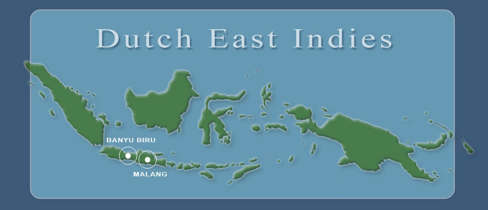
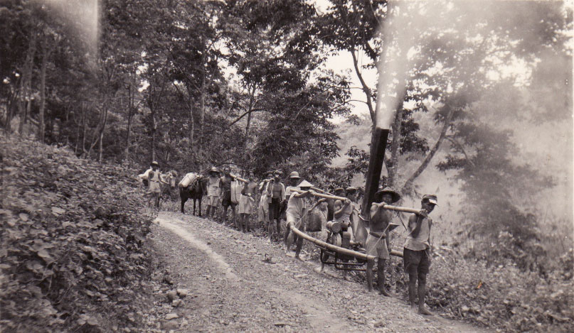
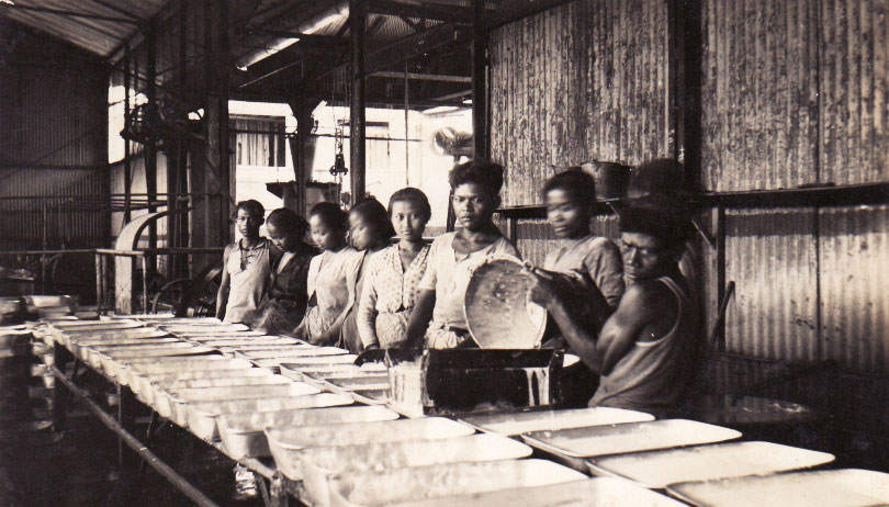
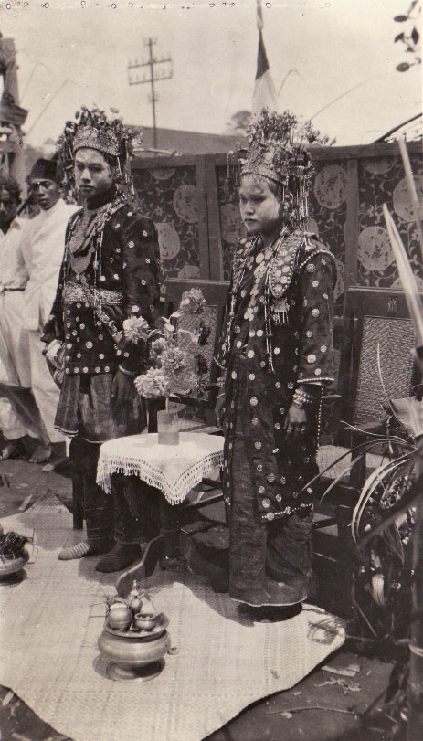

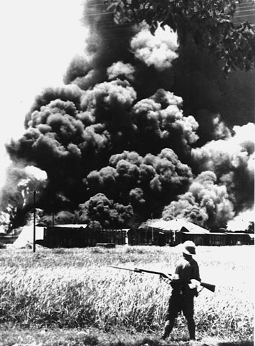
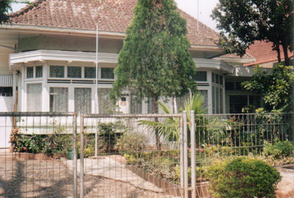
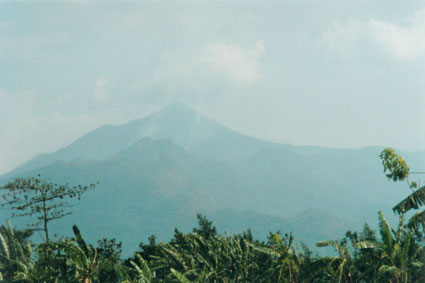

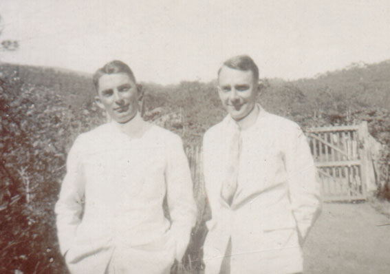
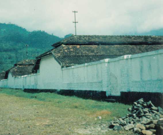


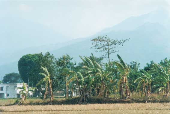
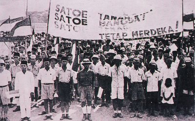


01.jpg)


 Decal
for $4.00")
 Bumper Sticker
for $5.00")


 3" Lapel Sticker (48 pk)
for $30.00")


for $30.00")


